A friendly reminder that there will be no Weekend Coffee Share link-up on April 26 and May 3 as I will take a blogging break. Please plan to join me again on May 10 when I will resume hosting.
This week I had so much fun being outdoors every day, except Wednesday. I explored nature by bike and on foot and went to an outdoor light-based art exhibition. I am lucky to have wonderful places to explore and enjoy close to home. Here are some of the things I saw and did. To view captions, please click on the photos.
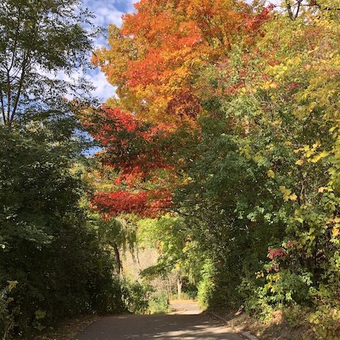
Don Valley Brick Works Park
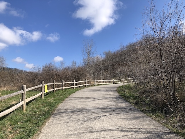
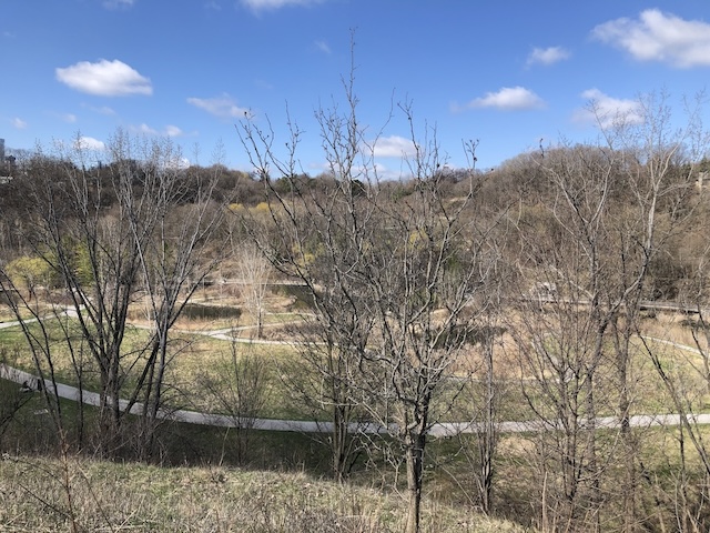
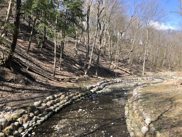
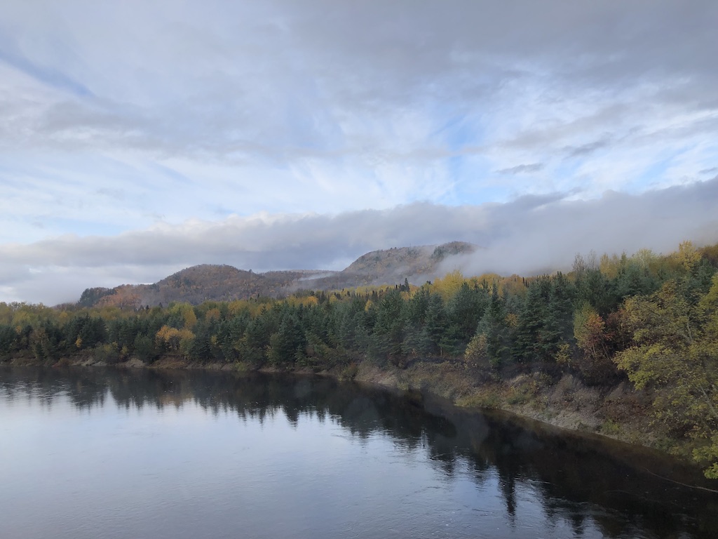
Outing 1: I set out for Don Valley Brick Works Park which was once a former quarry on a sunny and mild morning (12C or 54F). I cycled to the park then hiked for about two hours before cycling home.
I started from the quarry gardens at ground level then climbed up the steep trail to the quarry ridge lookout. After enjoying the views from the lookout, I made my way down a few switchbacks and over to the Belt Line Trail to walk the Mud Creek Loop.
It was a glorious and peaceful hike. I listened to the trickling sound of water in the creek, birds singing and squirrels foraging in the woods. Pretty coltsfoot flowers lined the trails and on the banks of the creek. On my way back, I watched turtles and saw a small garter snake in the grass.
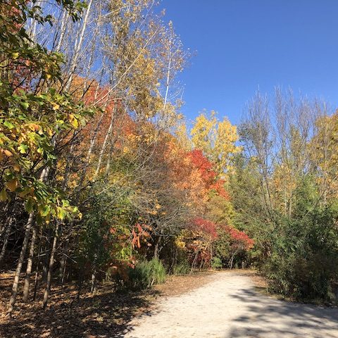
Sunnyside Beach
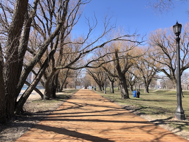
Outing 2: I rode my bike to Sunnyside Beach then jogged a 5 km loop along Lake Ontario’s Humber Bay. It was a beautiful sunny day with fantastic views of the bay. I love listening to the sounds of water gently touched the shore and birds singing.
The Sunnyside boardwalk was under reconstruction with the old section in grey and the new section with brown wood planks. As I returned to get my bike, I visited some of the swans and found two butterflies on dandelions.
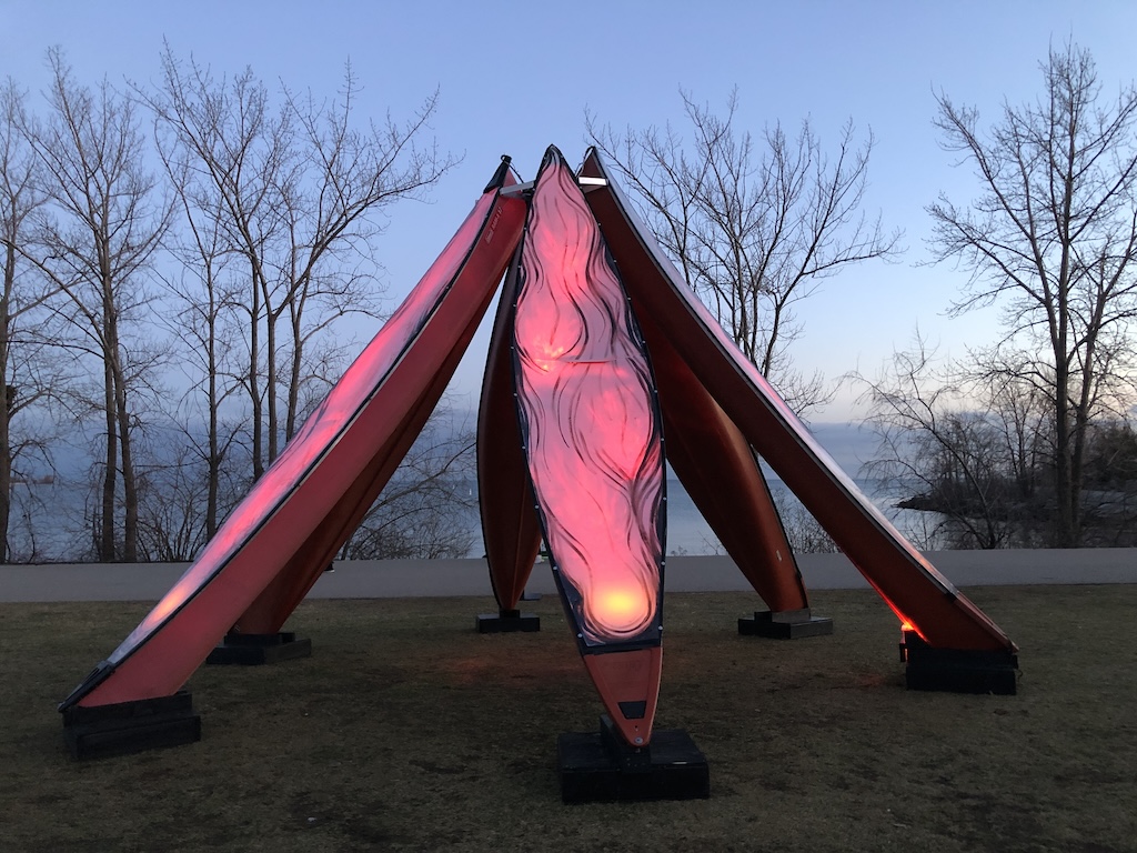
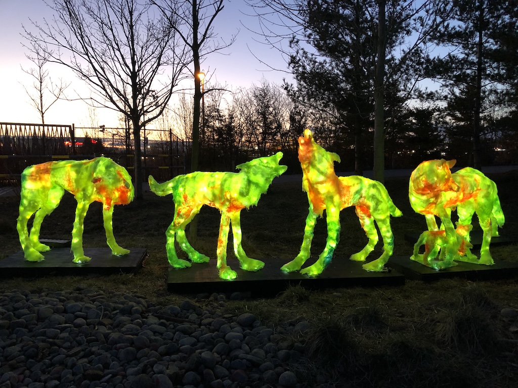
Lumière: The Art of Light
Outing 3: I enjoyed a lovely walk with a family member to see the free outdoor Lumière art exhibition at Trillium Park. The theme this year is Connections which aims to explore the various ways in which light can create connections between people, the environment, and different aspects of our lives. Here’s a sampling. To see all 17 light-based installations and their descriptions, please click here.
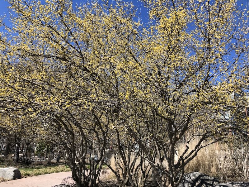
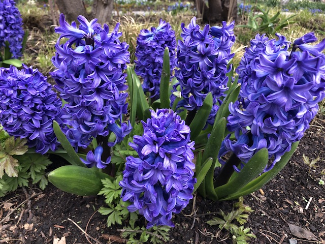
Gardens
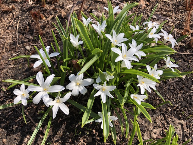
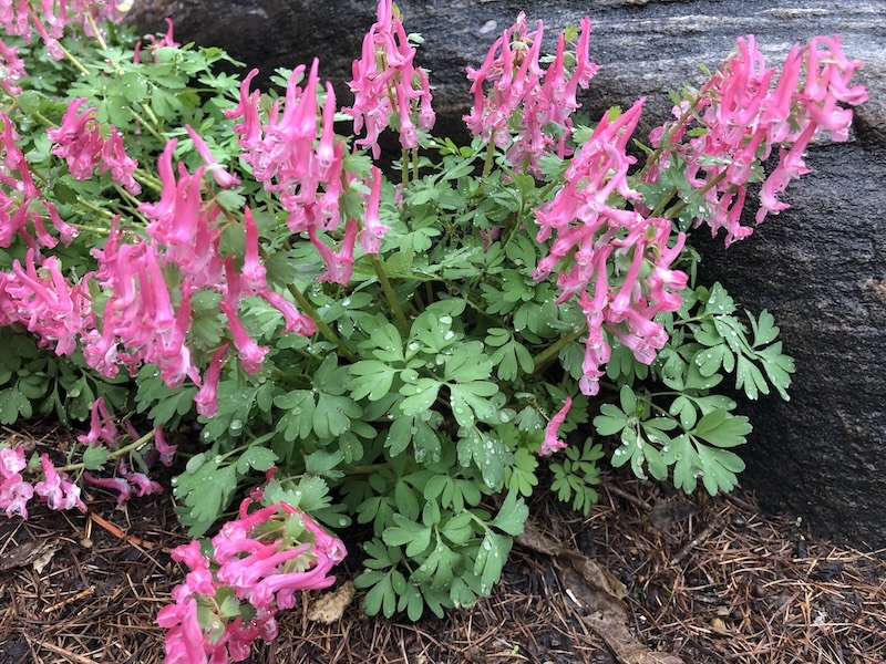
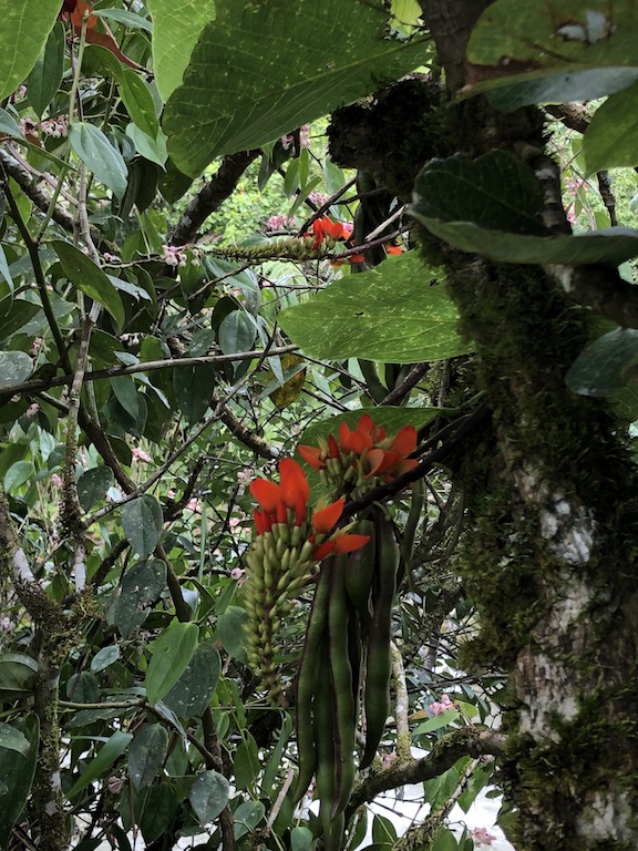
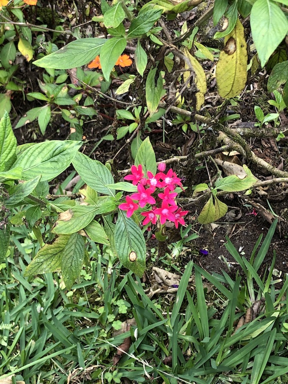
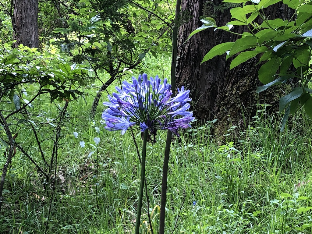
Outings 4 and 5: One final gallery to finish which shows a variety of spring flowers I spotted during my garden walks. Altogether, these outings made me a very happy explorer!
Link-Up
If I invited you to go for a walk, which outing would you choose? Feel free to choose more than one.
I’d love for you to share your week’s highlights and/ or public art from around the world in the Comments or Weekend Coffee Share link-up #161 below. The next Weekend Coffee Share link-up will be on May 10. Enjoy the rest of April and happy May!
This week I was going to write about my visit to Vatican City in March. Then I had a wonderful bike and hike excursion on Sunday that changed my mind. Nature wins! There will be a Vatican City blog post in due course, but it joins a long queue of things to write about.
Spring Hike
I set out for High Park on a beautiful, sunny and mild morning (12C or 54F). I rode my bike on the Waterfront Trail for about 45 minutes. Although I passed many scenic spots and landmarks along the shore of Lake Ontario, I made no stop until I reached the south end of High Park. From here, I started my hike along the lower trail that runs along Grenadier Pond.
Trail along Grenadier Pond
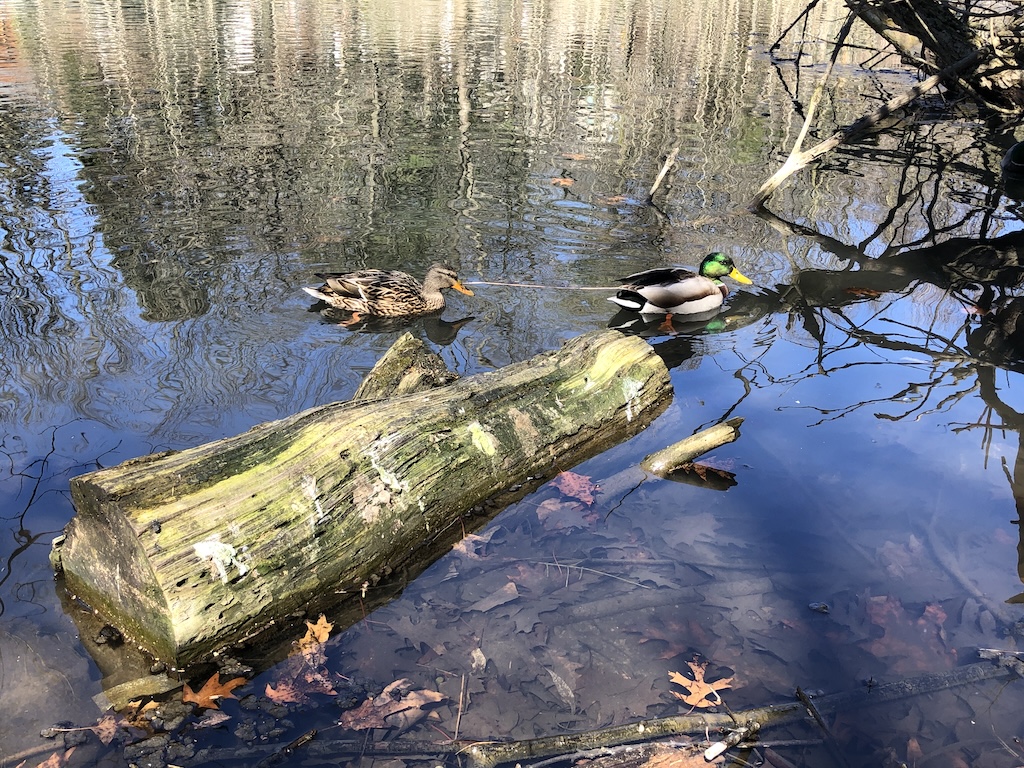
I saw two hawks, red cardinals, robins, common grackles and chickadees among the trees, as well as ducks, geese, swans and turtles in Grenadier Pond.
A duck couple
A beaver dam reminded me of my beaver sighting at the end of March when I saw a beaver chewing on a small tree trunk. It is common to see beaver dams in the wetlands around here but to see a beaver foraging on land at daytime is rare.
A beaver
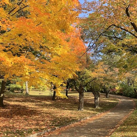
After reaching the end of the lower trail, I zigzagged my way to the upper trails. I love the magnificent tall trees that line these trails. They look bare in early April and will be green and leafy in the coming weeks. The small trees are already showing small green leaves.
Trail in High Park
Another section on the upper trails has trees with lighter trunks. I walked for a long time and just came across squirrels and birds along the way. What’s not in my picture is the beautiful bird songs that I heard.
Trail in High Park
Eventually I made my way down to the Maple Leaf Garden located at the bottom of Cherry Hill. This garden was officially opened by Queen Elizabeth during her visit to Toronto in 1958. In a few weeks and through to Fall, it will turn into an impressive floral display that is in the shape of a giant maple leaf.
Maple Leaf Garden in High Park
I hiked up the hill and was delighted to see a carpet of pretty puschkinia and daffodils. Puschkinia flowers have delicate white petals with blue stripes. They compliment the cheery yellow daffodils.
Puschkinia carpet in High Park
Daffodils and puschkinia flowers
I hiked down the steep hill towards Grenadier Pond and enjoyed the beautiful surroundings. In a few weeks, the flowering of the Sakura trees (cherry blossoms) will be spectacular here.
Steep hill in High Park
One last look at the marsh in Grenadier Pond before I returned to where I left my bike and cycled home.
Marshland at Grenadier Pond
It was a gorgeous day and a wonderful hike. I did 45 minutes cycling + 2 hours hiking + 45 minutes cycling for a total of 3.5 hours outdoors. This excursion made me a very happy explorer!
Solar Eclipse
On Monday April 8 at 3:19 p.m. I watched the rare total solar eclipse in Toronto. The sun rays were blocked and the surrounding landscape turned dark for a few minutes; dark enough for the street lights to turn on. After the eclipse was over, it was sunny again.
Link-Up
Please note that there will be a link-up on April 19 and no link-up on April 26 and May 3 as I will take a blogging break. I will repeat this announcement next week.
I’d love for you to share your week’s highlights and/ or public art from around the world in the Comments or Weekend Coffee Share link-up #160 below.
Hello and welcome to my blog! I’m glad you’re here. It’s week 32 in 2022 and I’m hosting Weekend Coffee Share linkup #82. Come on in for a coffee or tea, and let’s catch up.
In my previous post I shared a sampling of the delicious meals that I had in Newfoundland and Labrador. I worked them off by taking as many walks as possible. It was easy to do because the province has 29,000 kilometres of pristine coastline and close to 300 hiking and walking trails.
Here are five scenic walks that I enjoyed in western Newfoundland. As always, click on any image in the galleries to see its bigger version and caption.
1. Corner Brook Stream Trail
I was staying at Glynmill Inn and the Corner Brook Stream Trail was steps from the inn entrance so I did two walks, one in the morning and one in the afternoon in opposite directions. The trails are well defined with minimal elevation.
The morning walk took me along the beautiful trail to the wetlands and into the forest. Pretty wildflowers, bright dandelions and adorable chipmunks were part of a wonderful start to my day.
The afternoon walk took me to another beautiful forest, then a bridge that crosses rushing waters and Glynmill Inn Pond with swans before I returned to Glynmill Inn.
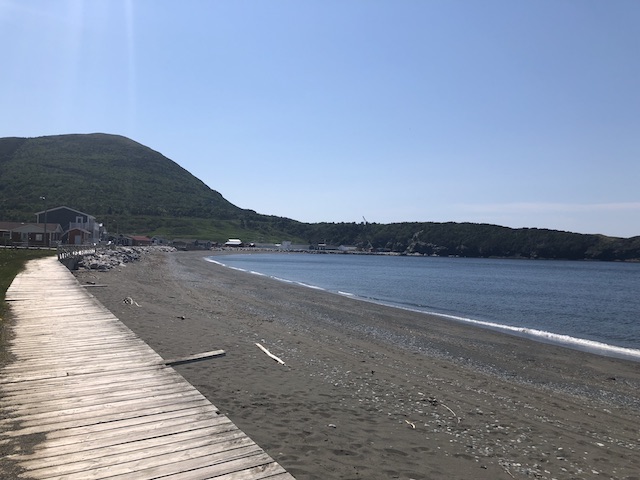
2. Trout River Boardwalk
Trout River is a small rural fishing town located on the southern coastal edge of Gros Morne National Park, near the Tablelands. This town is known for its boardwalk and trails that connect to the National Park. I enjoyed the views over the water and a walk through town.
Trout River was settled in 1815 by George Crocker and his family, who were its only inhabitants until 1880. In 2014, a blue whale carcass washed up along the shore in Trout River which attracted international attention. The skeleton of this whale was later put on display at the Royal Ontario Museum in Toronto.
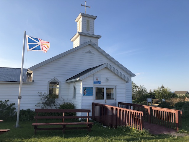
3. Shallow Bay Trail
This 1.3-km loop trail is easy and perfect when short on time. I extended my walk to see St. Mary’s botanical garden, St. Mary’s church, and Dr. Henry N. Payne Museum & Craft Shop (the longest running museum on the West Coast of Newfoundland). I returned to Shallow Bay just in time for a spectacular sunset.
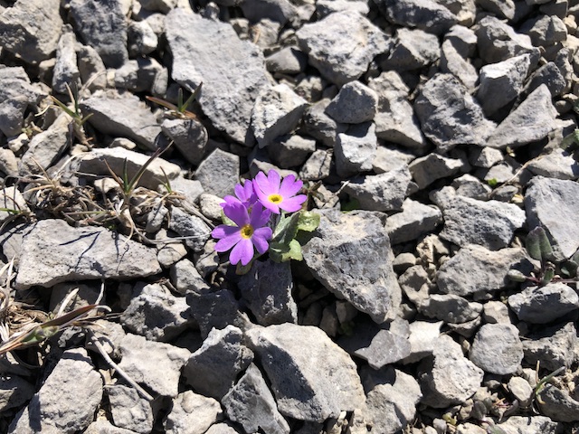
4. The Dorset Trail, Port au Choix
The Dorset Trail winds across limestone barrens and through forest and heathland to coastal archaeological sites dating back 2,800 years. This was one of my favourite trails for the unusual landscape. Although the ground may look bare, when I took a closer look, to my delight, I discovered many plants living and thriving on these barrens.
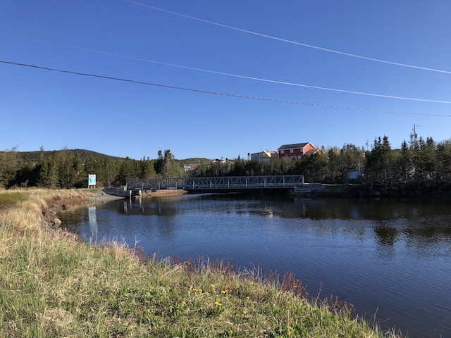
5. Bottom Brook Trail
Bottom Brook received its name due to its location at the bottom of St. Anthony Harbour. The 1.4-km loop trail is an easy walk on a beautiful morning to start my day. After the walk, I took a boat tour from St. Anthony Harbour to see icebergs, seabirds and whales.
*****
I love the uniqueness of the above walks and their beautiful natural surroundings. They are simple walks that I could fit in first thing in the morning to warm up, or last thing in the evening to wind down. I hope you enjoy the landscape as much as I did.
Welcome to the second Wellness Weekend link-up in 2020! I hope everyone had a nice Valentine’s weekend and your wellness plans for 2020 have been going well. The optional prompt for February is Hiking so I’m sharing a moderate hike to the Devil’s Cauldron waterfall. My sister and I completed this hike when we were in Baños, Ecuador.
Where is Devil’s Cauldron Waterfall?
Baños (full name Baños de Agua Santa) is located about 180 km (112 miles) south of Quito. This town is known for its waterfalls, hiking trails, and hot springs. The Devil’s Cauldron waterfall (El Pailon del Diablo) is 18 km from the town centre. It’s one of Ecuador’s most powerful waterfalls and one of the top rated attractions in Baños.
How challenging is this hike?
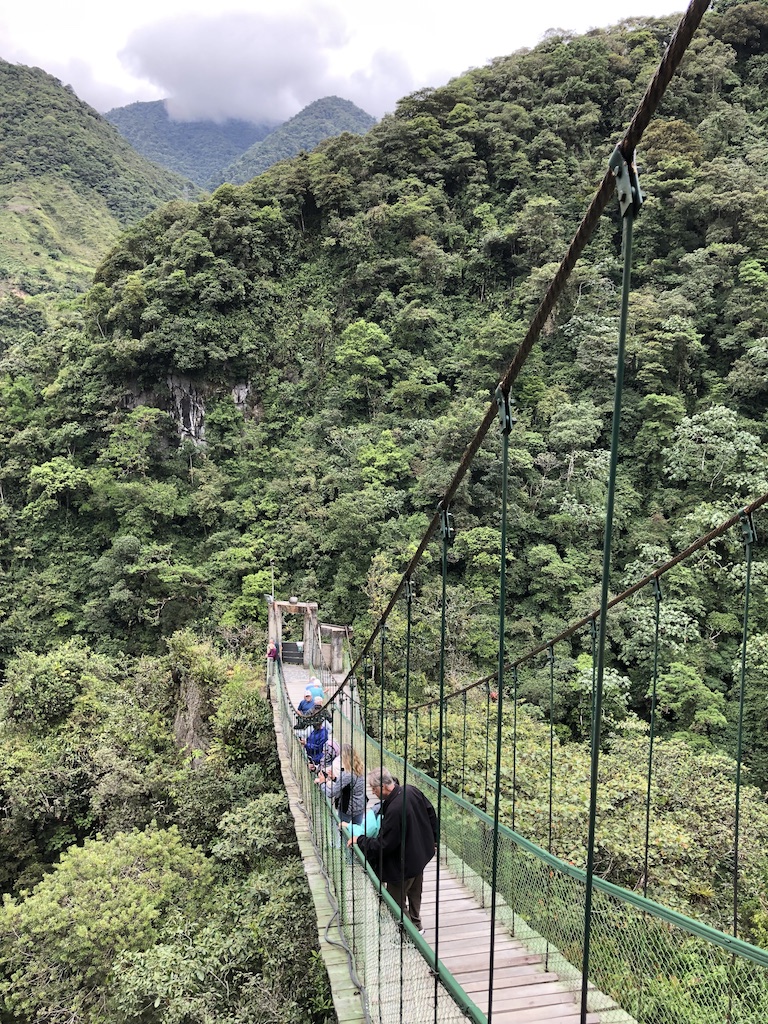
I classify this hike as Moderate because although the path is clearly marked, it has uneven surfaces. It also involves stairs and a suspension bridge. As long as you watch your step and are not afraid of heights or suspension bridges, the hike is rewarding.
Let’s hike together!
We started following the Green River (Rio Verde) to the Isla del Pailon entrance. While there are other entry points, this entrance lets us see the full height of the waterfall. Entry fee was $2 per adult and $1 per child.
The Green River (Rio Verde) in Baños, Ecuador
The water flow was strong, rushing by the black volcanic rocks seen along the river banks. On the right of the photo below, the walking path is behind the low lichen-covered stone wall. We soon understood why the wall is essential for our safety.
The Green River flows towards a cliff
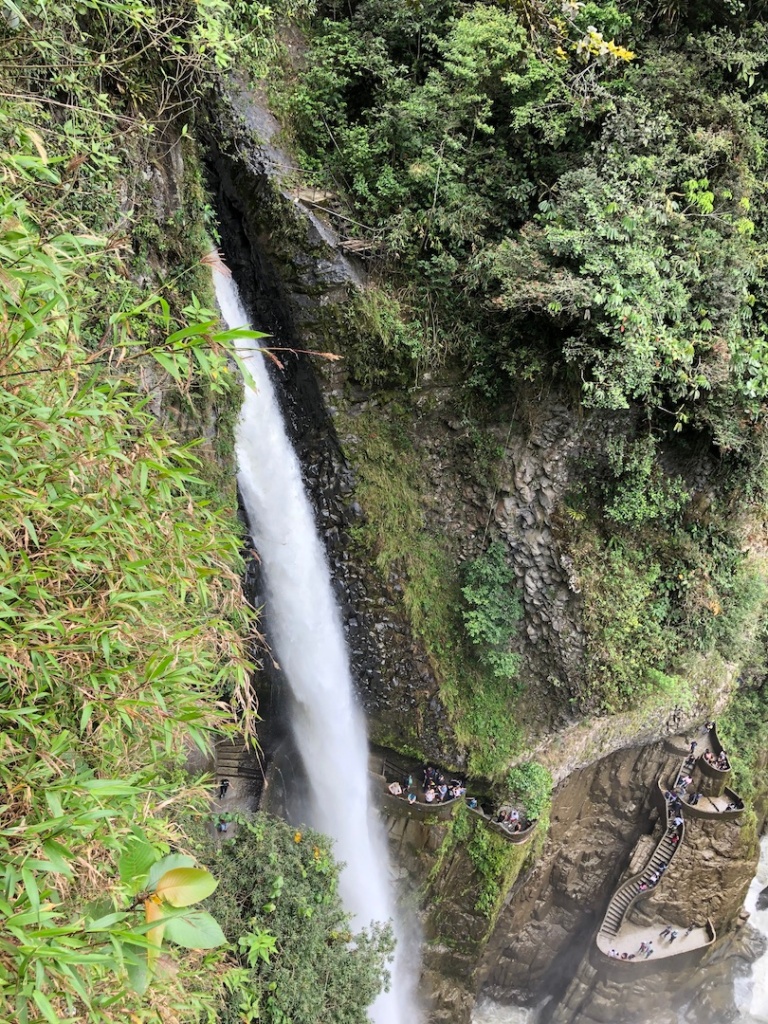
We followed the stone path and reached the suspension bridge. On the left, we saw the side views of the Devil’s Cauldron waterfall which plunges some 80 meters (263 feet) over a sheer cliff to the rocks below.
Side view of Devil’s Cauldron waterfall
It’s necessary to cross the suspension bridge to see the full view of the waterfall and to understand why it’s called the Devil’s Cauldron. The maximum capacity of the bridge is 50 people. Of course it swayed as people got on it. Crossing the suspension bridge was stepping outside my comfort zone but I did it!
Suspension bridge at Devil’s Cauldron waterfall
At the other end of the suspension bridge, we faced the Devil’s Cauldron waterfall. It is beautiful and powerful. Its appearance and sheer force are mesmerizing. People who stood at the Lookout platforms below looked so small next to the waterfall.
Devil’s Cauldron waterfall, Baños, Ecuador
We continued to descend the path to the lower level. When we stood at the Lookout place, we could feel the mists, see the curtains of water, and hear the thundering sounds of the powerful waterfall plunging straight down to the bottom.
Devil’s Cauldron waterfall
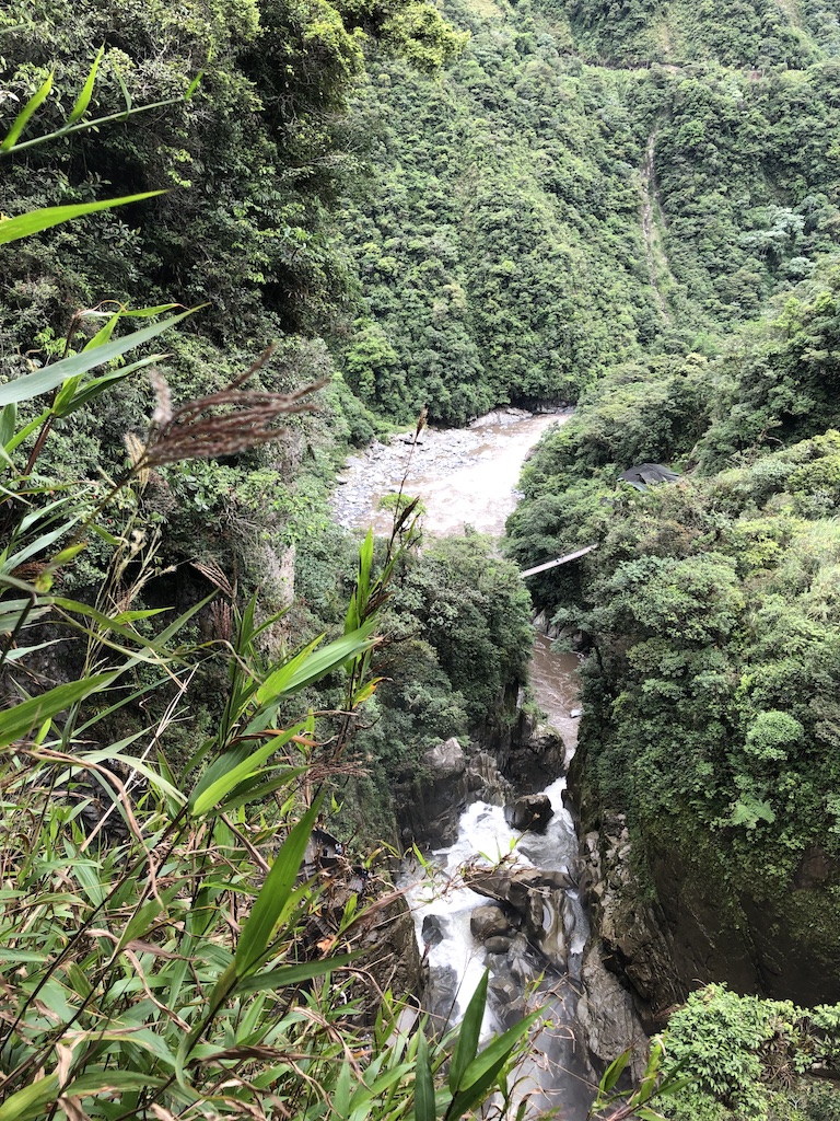
We could see the rocky bottom where water was churning before it settled into a smoother flow and another suspension bridge looking like a thin stick at a distance.
It’s amazing that the stone path was carved out of the cliff side to allow visitors to get close to the waterfall. The surrounding scenery was also beautiful with cascades running down the mountain sides.
Cascades near Devil’s Cauldron waterfall
We walked back to cross the suspension bridge and exited the same way that we came in. On our way out, we stopped to admire a variety of pretty flowers grown along the path. I’m sharing a small sample below.
Gratitude moment
I’m grateful for another amazing day and another wonderful hike in Ecuador with my sister. Altogether we did about 3 km return trip with stairs and suspension bridge crossings. We learned something new about the Devil’s Cauldron waterfall. The hike and nature gave me new energy. I’m looking forward to our next hike.
Click here to join in the Wellness Weekend 2020 link-up and share your wellness-related post. As your host, I will read your blog and leave a comment.
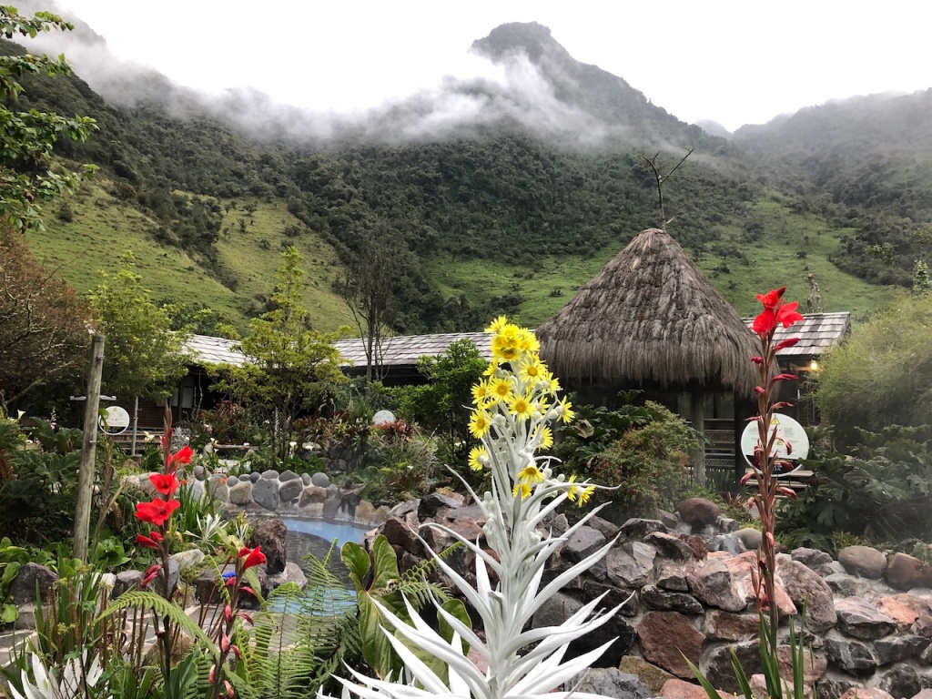
During my travels, sometimes I discover places that exceed my expectations. The Termas de Papallacta (Papallacta Hot Springs) resort in Ecuador was one of them. Our stay there turned out to be one of my 10 favourite experiences in Ecuador. Let me share some of my photos and brief descriptions with you.
[This is not a sponsored post. There is no affiliate link in this blog.]
Where is Papallacta?
Papallacta is a small town about 70 km (43 miles) east of Quito, the capital of Ecuador. Papallacta is located at an altitude of 3,250 metres (10,600 feet) in the Andes, at the edge of the Cloud forest.
Where are the Papallacta hot springs?
Papallacta hot springs are located on the banks of the Papallacta river in between Antisana and Cayambe-Coca Nature Reserves. Two nearby volcanoes, Cotopaxi and Antisana, create thermal baths which vary between 30°C and 70°C (86°F and 158°F).
How to get there?
By car it’s about an hour drive from Quito’s Mariscal Sucre International airport (UIO), and about 1.5 hours from Quito’s city centre. Visitors can also book day tours or take local buses to Papallacta.
Where to stay?
I recommend the Termas de Papallacta (Papallacta Hot Springs) resort for its location and amenities. The resort has a large public bathing complex, a hotel, and a separate spa complex. The natural hot springs in Papallacta feed the thermal pools in the hotel.
What to enjoy at Termas de Papallacta resort?
Thermal pools: Termas de Papallacta resort offers three different sets of pools:
Private pools right outside the hotel cabins and rooms: These shallow pools, surrounded by rocks and pretty flowers, are free and exclusive for guests of the resort.
Public thermal bath complex (the Balneario): This complex has at least ten different pools with varying temperatures. These pools are open daily to the public with admission fees. For hotel guests, entrance is free.
The Spa complex: This complex has five thermal pools equipped with various water jets, bubbles, water spouts and one polar pool. The pool area has garden-like setting of flagstones and flowers, with plenty of lounge chairs. These pools are open to the public at higher admission fees than the public baths. For hotel guests, the spa pool entrance fees are discounted.
The entrance fee for the Spa complex includes a locker, bathing cap, and towel. The change rooms in the Spa area are more luxe than the public bath complex, with heated floors, complimentary shampoo, conditioner and blow dryers. Bathrobe rental is extra.
If you’re spending just one day at Termas de Papallacta, I’d suggest to pay for entrance to the public pools at the Balneario or for the pools at the Spa complex. At the pools the temperature ranges from 36°C to 38°C (97°F to 100.4°F).
Hiking trails: Termas de Papallacta owns a protected area of approximately 200 hectares, called Canyon Ranch, located at the entrance of Cayambe-Coca Nature Reserve. Visitors can explore the hiking trails on their own or for a few US dollars, book a guided hike at the Exploratorium in the resort.
The Exploratorium is a research centre that provides information on the different species of flora and fauna found around Papallacta, some unique to the area. Up in the highlands, the cool air is great for hiking and makes lying in the hot pools that much better.
Hotel rooms: The hotel rooms are made of preserved wood with private bathroom and heated flooring. The rooms are situated around the thermal water pools for exclusive guest use. There are also bungalows for families and cottages separate from the hotel area.
Spa services: My sister and I booked a spa package which includes 30 minutes in the Spa thermal pools, a 20-minute steam bath in a thermal grotto, and a 30-minute back and neck massage. The steam bath grotto has hot water trickles over rocks and eucalyptus leaves while guests relax on deck chairs. There is an area for guests to rest before the massage.
On-site bar and restaurant: The hotel restaurant offers Ecuadorian and international fare using ingredients from the organic kitchen garden. I enjoyed the quinoa soup and local fresh trout, the restaurant’s specialty dish, for dinner.
My Conclusion
Termas de Papallacta resort offers the perfect pairing of recreation and relaxation. I can hike then rest or rest then hike in a magical setting. This is a stunning area for nature walks, mountain views, and hot springs. If you’re in Quito, consider a visit to the Papallacta Hot Springs. I highly recommend it!
Welcome to the first Wellness Weekend link-up in 2020! I hope the first eighteen days of January have gone well for everyone and you’ve got some time to warm up before tackling your New Year’s plans with gusto.
Why Warm Up?
A warm-up is helpful at the beginning of a fitness session to get our mind and body ready for subsequent and more intense activities. In my previous post, I shared that one of my ten favourite experiences in Ecuador is hiking. The first hike that my sister and I did is an easy hike to Peguche waterfall near Otavalo. It’s our warm-up hike to prepare us for more strenuous hikes later on.
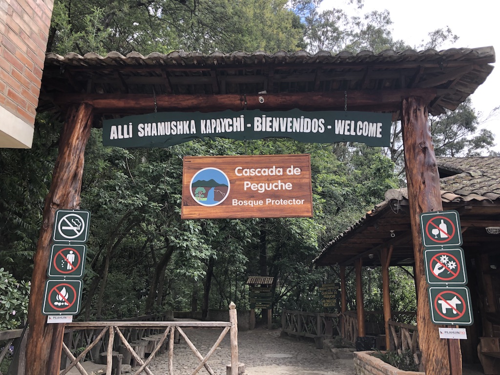
About Peguche Waterfall
Peguche waterfall is 5 minutes northwest of the city of Otavalo which is located 110 km north of Quito and 2530 meters above sea level. Peguche waterfall is a sacred place in the culture of the indigenous peoples of Otavalo.
I categorize this hike as Easy because the trail is flat and well-defined. The length of the trail is just right (about 3 km return). There are a few points of interest along the way, and the highlight is a beautiful waterfall. Otavalo’s spring-like climate in December also makes it ideal for hiking. So we headed to Peguche trail.
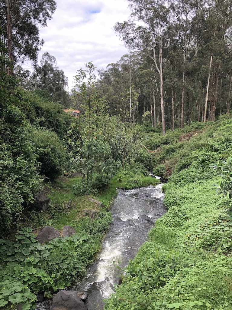
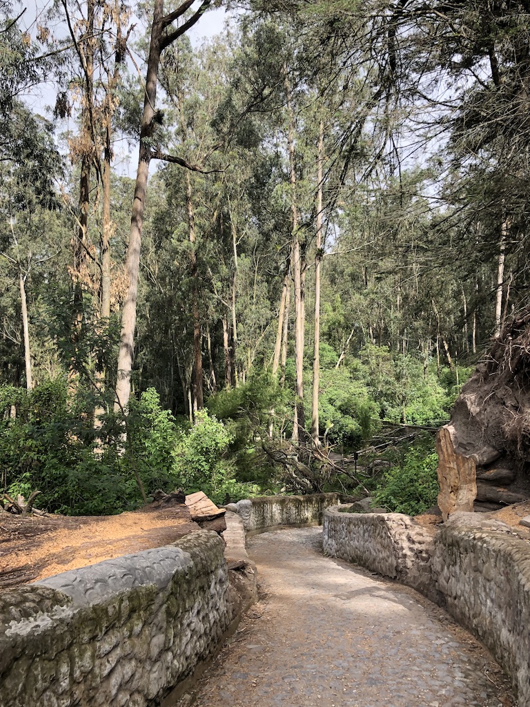
Once we entered the Peguche trail, we were surrounded by beautiful tall trees and lush green shrubs. The winding path was easy to walk on. Mosses and lichen covered the low rock walls that protect the trees from foot traffic.
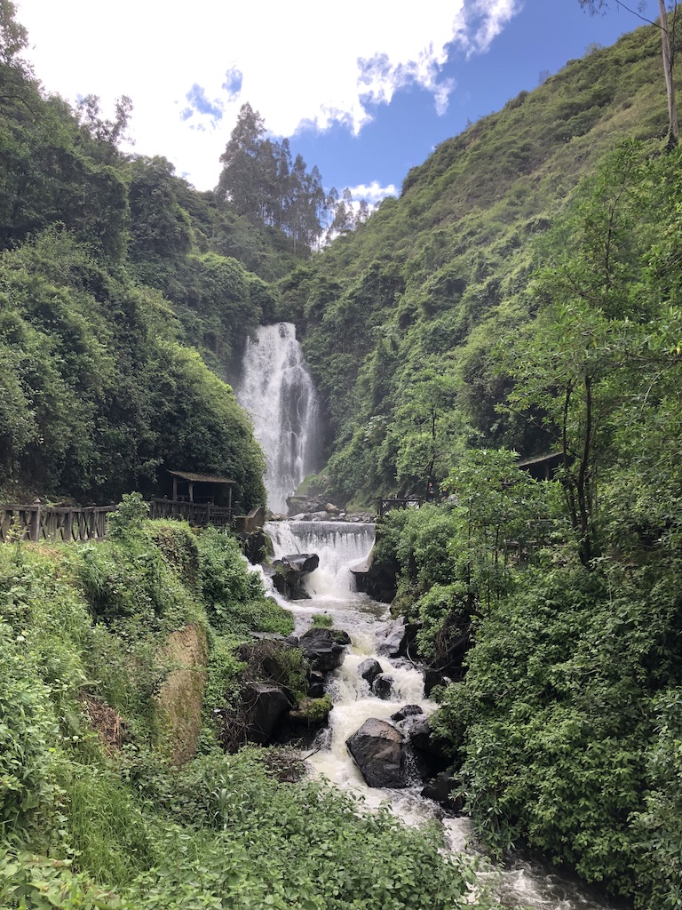
The trail is about 1.5 km long. It took us about twenty minutes to reach the bridge that faces the waterfall. Peguche waterfall is a beautiful waterfall of 18 m in height, formed by the river of the same name, which starts at Lake San Pablo. The lush green vegetation embraces the waterfall. The clouds moved in and out to give us some sun.
We stood on the bridge for a while to enjoy the views before walking up the paths along both sides of the falls to reach the Lookout platform (Mirador), and onto some big rocks to get closer to the waterfall. We could feel great volumes of mist from the powerful waterfall.
The local people name Peguche waterfall Forest Protector (Bosque Protector), because all of the trees get their water from the waterfall’s mists and the downstream gushing water. On the night of the summer solstice, the waterfall becomes the privileged place for community ritual bath, as a first step to celebrate the Festival of the Sun (Inti Raymi).
As we walked along the trail, I could hear bird songs and spotted a number of plants with pretty flowers. There were also lots of ferns and orchid plants that cohabit with tall eucalyptus trees. The sun came out and everything glowed.
Outside the Peguche trail, to the left is the Sun Dial (Inti Watana) site, also known as the Solar Calendar. The site includes a round adobe wall with a sun dial in the centre. People from different communities come together to offer their crops to the Sun god (Inti), and celebrate the summer solstice here.
It was a nice short hike on a beautiful morning in Peguche. Altogether we did about 3 km return trip (about 2 miles). We learned something new about Peguche waterfall. The warm-up hike and nature gave me new energy. I looked forward to more hiking in Ecuador. Happy trails!
Click hereto join in the Wellness Weekend 2020 link-up and share your wellness-related post. As your host, I will read your blog and leave a comment.
Last month my sister and I made a trip to Ecuador, a country on the Pacific side of South America. Our itinerary included visits to Quito, Otavalo, Papallacta, the Amazon, Banōs, and Patate. We had a wonderful time with numerous memorable moments.
I love so many things about Ecuador and it’s tough to name my ten favourite experiences. Nevertheless, I’m listing ten for now and plan to write more details in the next few posts.
My 10 Favourite Experiences in Ecuador
1. Visit Quito and its historic centre: Quito, founded in 1534, is the capital city of Ecuador. The historic centre of Quito was one of the first centers of its kind to be declared a UNESCO World Heritage Site in 1978. A good place to see the panoramic view of Quito is at Itchimbia Park.
Quito sign at Itchimbia Park
View of Quito from Itchimbia Park
We walk the cobblestone streets in Quito’s historic centre and visit some of the beautifully restored colonial-era churches, palaces, and public plazas, such as the Independence Plaza, the Cathedral, Presidential Palace, and the Archbishop’s Palace, La Compañia de Jesus Church with its beautiful gilded interior, and the Church and Monastery of San Francisco with its impressive facade and atrium.
Independence Plaza in Quito
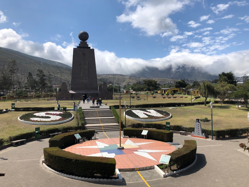
2. Straddle the Equator at the Middle of the World Monument: The country is called Ecuador as the Equator passes right through it. We visit the Middle of the World Monument which commemorates the first Geodesic Mission of the French Academy of Sciences. This is where Louis Godin, Pierre Bouguer, and Charles Marie de La Condamine first determined the equatorial line in 1736.
Even though GPS measures later proved that their magnetic measurements were flawed, and the actual equator is located 250 meters from the monument, it’s still a nice place to visit and to stand at a latitude of 0º0’0” with one foot in the Northern and one in the Southern Hemisphere.
Middle of the World Monument at Latitude 0º0’0”
3. Hike and hike some more: We hike to Peguche waterfall near Otavalo, and the Devil’s Cauldron waterfall near Baños. The landscape that we see along the Pan-American Highway is breathtaking. The most strenuous hike for us, however, is in the Amazon rainforest.
Mountains and San Pablo lake near Otavalo
Morning view of San Pablo lake
Peguche waterfall
4. Shop at the Otavalo market: The Otavalo market is one of the largest in South America run by the local Otavaleños. Here, we enjoy the lively market atmosphere and browse the various stalls for traditional goods such as handwoven cloth and rugs, Panama hats, art work, jewelry, and more.
Otavalo main square
The Panama hats, by the way, are made in Ecuador, and not Panama. The construction of the Panama Canal caused a great demand for toquilla straw hats from Ecuador, because of their qualities to protect from the sun. From Panama the hat was internationally known and people began to call it “Panama Hat” even though the place of origin is Ecuador.
Art for sale at Otavalo market
5. Relax at the Papallacta hot springs: Ecuador has many volcanoes hence hot springs are plentiful. We enjoy the thermal hot pools and our overnight stay at Termas Papallacta hotel and spa. It’s a beautiful place to relax and recharge before we go to the Amazon rainforest.
Papallacta hot springs
6. Explore the Amazon rainforest: We stay at a lodge in a lush tropical and tranquil setting on the banks of the Napo river in the Amazon Basin. Birds, flowers, and sounds of nature and nocturnal animals fill our senses. We go on a guided and challenging hike for approximately two hours while viewing many species of tropical plants and insects up close.
The Amazon rainforestBoat in the shade of the Amazon jungle
7. Visit beautiful colonial-Spanish haciendas: We stay at Hacienda Leito which provides a fabulous mix of old and new. The original ranch building, with its original cobblestone driveway, central fountain, and antique artworks and furnishings, is a classic example of a colonial-Spanish hacienda. The up-to-date rooms and free Wi-Fi let you know you’re in the 21st century.
Hacienda Leito entrance
On another day, we lunch at Hacienda La Cienega, one of the oldest and most historical haciendas in Ecuador, dating back to the 17th century, with a view of the snow-capped Cotopaxi volcano, in the background.
The old chapel at Hacienda La Cienega
8. Try Ecuadorian food: We try various dishes in Ecuador and like most of them such as ceviche, quinoa soup, potato soup, shrimps and grilled fish. We did not try cuy (guinea pig). There are also lots of fresh and inexpensive fruit such as bananas, plantains, papayas, and chirimoyas. Ecuador cacao and chocolate taste divine in their desserts and hot chocolate drinks.
Cacoa-based desserts
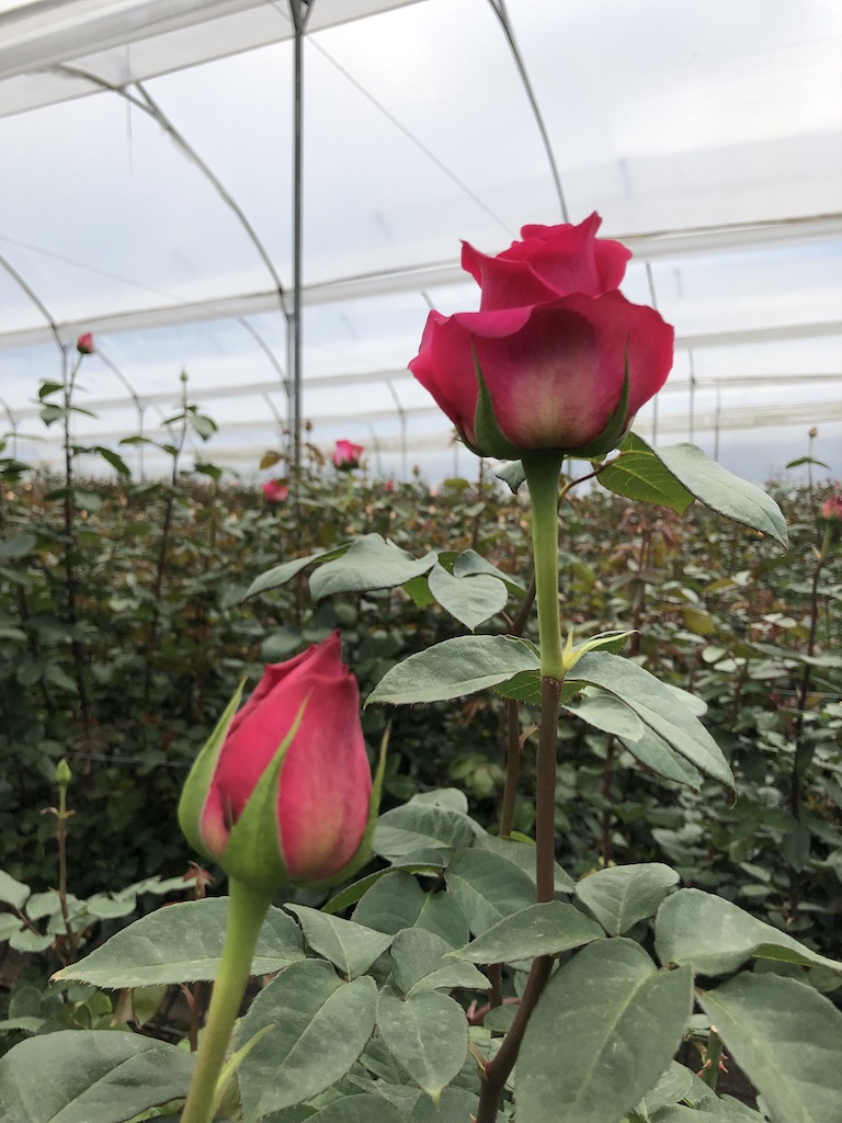
9. Tour a beautiful rose plantation: Although roses are not native to Ecuador, the country has a perfect environment for rose cultivation and is presently one of the world’s major producers. On the plantation tour, we learn about the farming process, from planting to exporting, and admire numerous rose varieties.
Rose plantation
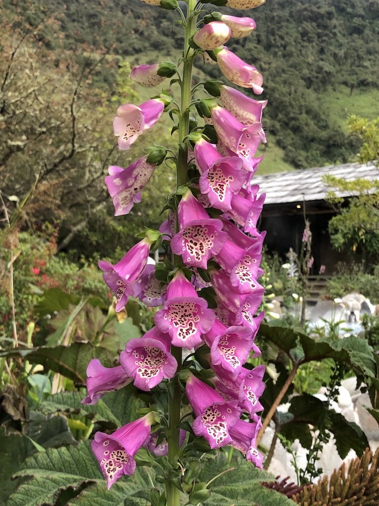
10. Watch nature, local fauna and flora: While in Ecuador, we are surrounded by nature and innumerable varieties of fauna and flora. I take in the lush vegetation, mountains, volcanoes, lakes, lagoons, waterfalls, rainforest, and cloud forests as much as I can. Below is a sample. I hope you see the hummingbird on the right of the red flower.
Hummingbird by a red flower
Tungurahua volcano at dusk
Many tourists come to Ecuador and jump from Quito or Guyaquil to the Galapagos Islands. There is much more to Ecuador than the Galapagos. I’m happy with what I’ve experienced on my first visit to beautiful Ecuador: culture, history, nature, food and its people. I hope you enjoy seeing Ecuador through my lens.
Have you been to Ecuador? What do you think? I’d love to hear your comments.
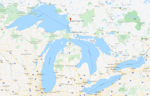
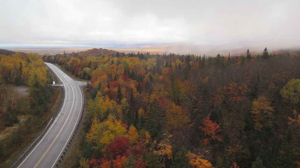
After enjoying a nice family hike along the Attikamek Trail in Sault Ste. Marie, the next day we took a rail excursion from Sault Ste. Marie to Agawa Canyon Park. Agawa Canyon has been on our list of destinations to visit for a while. We were so glad to make it happen.
Getting There
The Agawa Canyon Park is only accessible by hiking trail or the Algoma Central Railway, and is located 186 km or 114 rail miles north west of Sault Ste. Marie. We take the Agawa Canyon tour train that departs from Sault Ste. Marie at 8 am and arrives back in Sault Ste. Marie around 6 pm.
Agawa Canyon Park location (red marker)
About Agawa Canyon
Agawa Canyon was created more than 1.2 billion years ago by faulting along the Canadian Shield. A series of ice ages subsequently widened and reshaped the Canyon over a period of 1.5 million years with the last ice age retreating about 10,000 years ago. The word Agawa is native Ojibway for “shelter”.
The Sault Ste. Marie visitor guide provides a map of three nature trails in the Agawa Canyon Park. They are the Lookout Trail, River Trail, and Talus Trail. We hike the River Trail and the Talus Trail for the three waterfalls in the park. The Lookout Trail is closed on the day of our visit. The trails are well maintained and are covered in fine gravel.
The Train Ride
Rarely is the journey as rewarding as the destination, but the Agawa Canyon train ride is truly an exception. The train is outfitted with large tinted windows and comfortable seats to watch the ever-changing and breathtaking Northern Ontario landscapes. The train ticket includes a $10 voucher that we can use for food and drinks in the dining car.
Spruce Lake
We drink in the beautiful scenery as the train hugs the shores of northern lakes and rivers, crosses towering trestles, and passes by mixed forests that turn red, purple, gold and yellow in the fall.
Autumn foliage towards Lake Superior
We also listen to a GPS-triggered audio commentary about key points of interest and the rich history of the region. When we can peel our eyes away from the window, the train has locomotive-mounted cameras that provide an engineer’s “eye-view” via flat screen monitors installed throughout the coaches.
A view from our window on the Agawa Canyon train
The Weather
The weather changes frequently during our train ride, from overcast, to partly cloudy, to light snow flurries at high elevation, to partly sunny as the train starts its descent into the canyon at Mile 102 and full sunshine by the time we reach the canyon floor at Mile 114.
Light dusting of snow at high elevation
Full sunshine upon train arrival at Agawa Canyon Park
The River Trail
Upon arriving at the Agawa Canyon Park, we start our hike on the River Trail which gently rolls along the banks of the Agawa River. The strong sunlight quickly melts the thin layer of snow. The trail glows and smells fresh as if it just received a spa treatment.
Autumn colours by the Agawa River
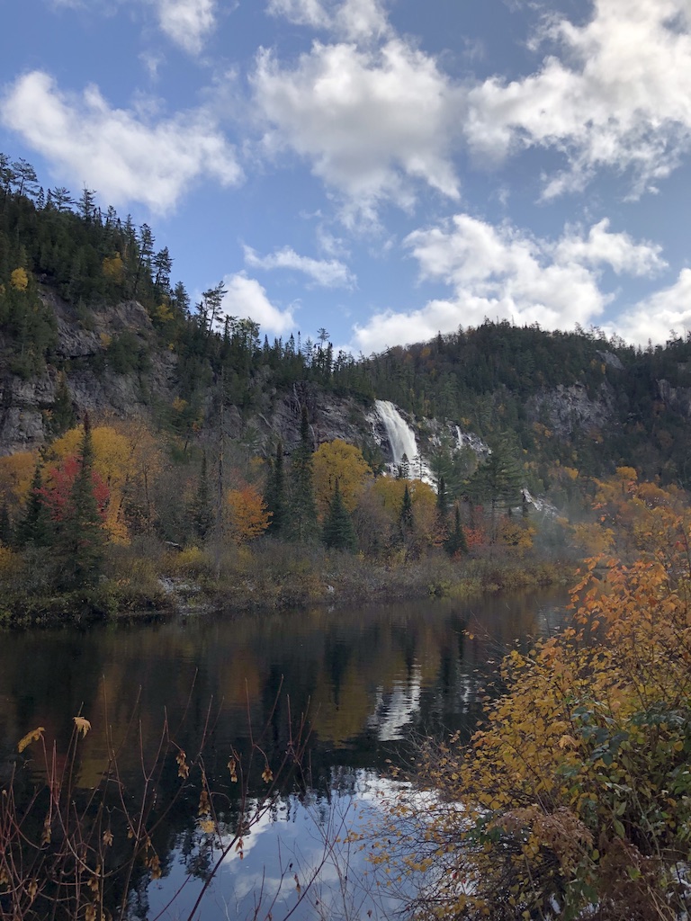
We walk about twenty minutes, enjoy the trail and the vibrant autumn colours along the river before reaching the beautiful Bridal Veils Falls, the tallest waterfall in the park.
View along the River Trail
We see many white birch trees with their golden leaves and mountain ash trees with their red fruits that accentuate the landscape.
Mountain ash
The water flow at all the falls in the canyon is contingent on runoff from snow and rainfall. We luck out that Bridal Veil Falls at 68.5m (225 ft.) are running strong. The Agawa River is the calm and reflective barrier that holds us back from getting closer to the falls.
Bridal Veil Falls at 68.5 m (225 ft)
The Talus Trail
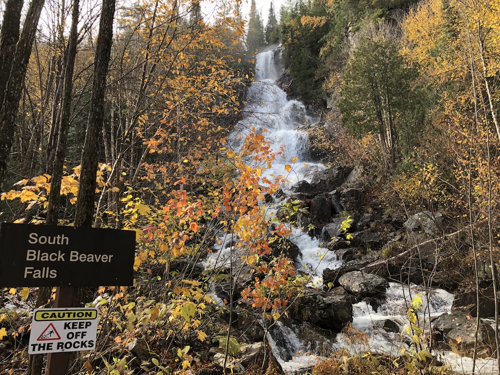
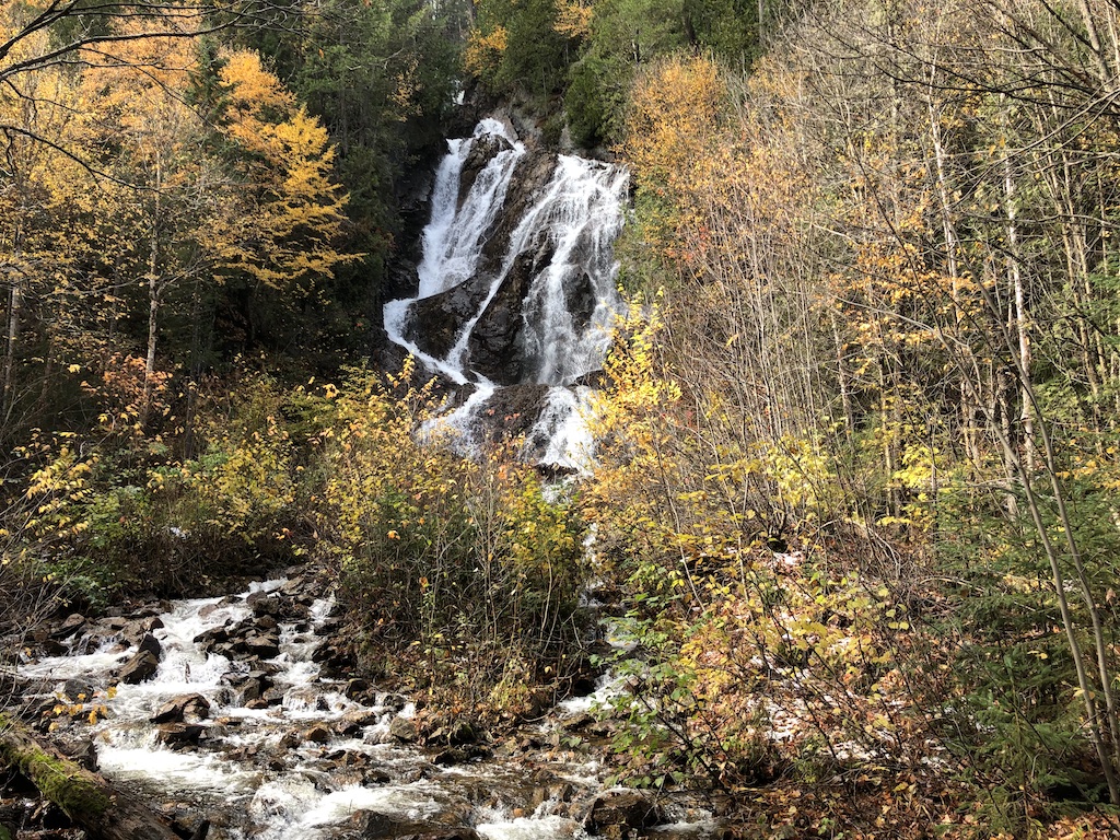
From the River Trail, we walk about fifteen minutes to reach the Talus Trail which follows along the base of the west canyon wall. This trail leads us past lichen covered talus slopes to the viewing platforms at North and South Black Beaver Falls.
The Talus Trail
We can hear the rushing sounds of water before reaching the viewing platforms. Black Beaver Falls at 53.3 m (175 ft) are also running strong and look so beautiful with the surrounding autumn foliage. We respect the Caution sign to keep off the rocks.
North Black Beaver Falls
South Black Beaver Falls
Clouds roll in and out while we pass bridges, creeks and waterfalls to return to the train. Altogether we walk 5 km and enjoy every minute of the hike in Agawa Canyon Park.
On our way back to Sault Ste. Marie, we get to see the spectacular landscapes again from our train windows. Everyone is wide-eyed to take in as much as possible the pristine beauty of Canada’s rugged wilderness.
I’m co-hosting the Wellness Wednesday November 13th link up with my blogger friend, Leslie. The optional prompt is Healthy Holidays so in this post I’m sharing a hike that my family and I did during our mini-vacation in Sault Ste. Marie, a city on the shore of the St Marys River connecting Lake Huron and Lake Superior.
Sault Ste. Marie, Ontario (green marker)
About the Attikamek Trail
The Attikamek Trail is located at the Sault Ste. Marie Canal National Historic Site of Canada, easily reached from the city centre. It’s 2.2 km long (1.4 miles) on flat terrain. Attikamek means white fish.
Hiking the Attikamek Trail
We started from the Sault Ste. Marie Canal gate, crossed the lock, and followed an accessible pathway onto south St. Marys Island. The weather was overcast, cool, and calm without any wind so it felt quite comfortable for an outdoor hike.
The Attikamek trail is on the left in this photo.
We soon entered the packed gravel trail path, surrounded by autumn foliage, from green to various shades of yellow and red. Part of the trail let us walk under the International Bridge, built in 1962.
The Sault Ste. Marie International Bridge spans the St. Marys River between the United States and Canada, connecting the twin cities of Sault Ste. Marie, Michigan and Sault Ste. Marie, Ontario.
We stopped by St. Marys Rapids to listen to the sounds of the water and watched a few dedicated fishermen patiently waiting for a good catch. The packed gravel and leaf-laden trail then turned into a wide wooden boardwalk with lovely views on both sides.
A flock of small birds happily greeted us at the boardwalk. They had light yellow and some black feathers. I think they’re warblers. Can you see a bird blended in with the berries in the centre of the photo below?
We enjoyed the calm reflection of autumn foliage, woods, and wetlands in the river. A family of ducks lazily swam along while other ducks were just watching us.
Further along the trail, we found a few beaver dams but no beaver in sight since they usually work at night. What looks like a heap of branches is protection against their predators and gives them access to food during winter.
A beaver dam
At the end of the Attikamek trail we reached the Sault Ste. Marie lock and walked around to examine how it works. The lock operation to raise or lower vessels that go from Lake Huron to Lake Superior is fascinating and deserves a separate blog post.
The lock is behind the white bridge at the end of the photo.
It was a nice short hike on a calm afternoon in Sault Ste. Marie. Altogether we walked about 3 km (1.8 miles) and experienced the wonder of quiet woods and wetlands. Happy trails!
Click here to join the Wellness Wednesday link-up and share your health goal updates or healthy holiday ideas.