After enjoying a nice family hike along the Attikamek Trail in Sault Ste. Marie, the next day we took a rail excursion from Sault Ste. Marie to Agawa Canyon Park. Agawa Canyon has been on our list of destinations to visit for a while. We were so glad to make it happen.
Getting There
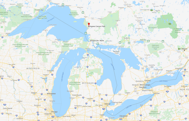
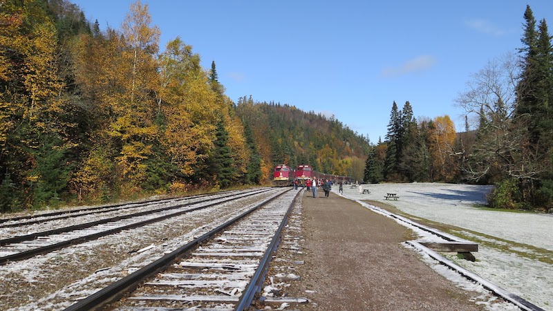
The Agawa Canyon Park is only accessible by hiking trail or the Algoma Central Railway, and is located 186 km or 114 rail miles north west of Sault Ste. Marie. We take the Agawa Canyon tour train that departs from Sault Ste. Marie at 8 am and arrives back in Sault Ste. Marie around 6 pm.
About Agawa Canyon
Agawa Canyon was created more than 1.2 billion years ago by faulting along the Canadian Shield. A series of ice ages subsequently widened and reshaped the Canyon over a period of 1.5 million years with the last ice age retreating about 10,000 years ago. The word Agawa is native Ojibway for “shelter”.
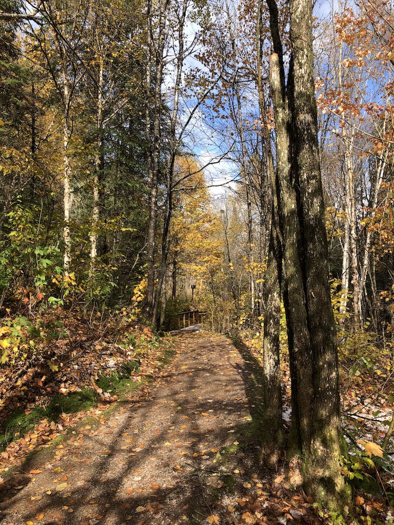
The Sault Ste. Marie visitor guide provides a map of three nature trails in the Agawa Canyon Park. They are the Lookout Trail, River Trail, and Talus Trail. We hike the River Trail and the Talus Trail for the three waterfalls in the park. The Lookout Trail is closed on the day of our visit. The trails are well maintained and are covered in fine gravel.
The Train Ride
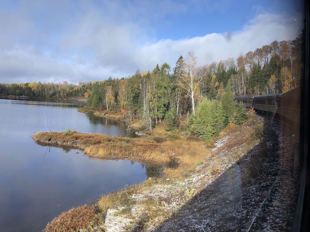
Rarely is the journey as rewarding as the destination, but the Agawa Canyon train ride is truly an exception. The train is outfitted with large tinted windows and comfortable seats to watch the ever-changing and breathtaking Northern Ontario landscapes. The train ticket includes a $10 voucher that we can use for food and drinks in the dining car.

We drink in the beautiful scenery as the train hugs the shores of northern lakes and rivers, crosses towering trestles, and passes by mixed forests that turn red, purple, gold and yellow in the fall.

We also listen to a GPS-triggered audio commentary about key points of interest and the rich history of the region. When we can peel our eyes away from the window, the train has locomotive-mounted cameras that provide an engineer’s “eye-view” via flat screen monitors installed throughout the coaches.
The Weather
The weather changes frequently during our train ride, from overcast, to partly cloudy, to light snow flurries at high elevation, to partly sunny as the train starts its descent into the canyon at Mile 102 and full sunshine by the time we reach the canyon floor at Mile 114.

The River Trail
Upon arriving at the Agawa Canyon Park, we start our hike on the River Trail which gently rolls along the banks of the Agawa River. The strong sunlight quickly melts the thin layer of snow. The trail glows and smells fresh as if it just received a spa treatment.
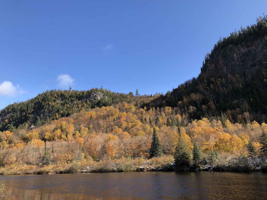
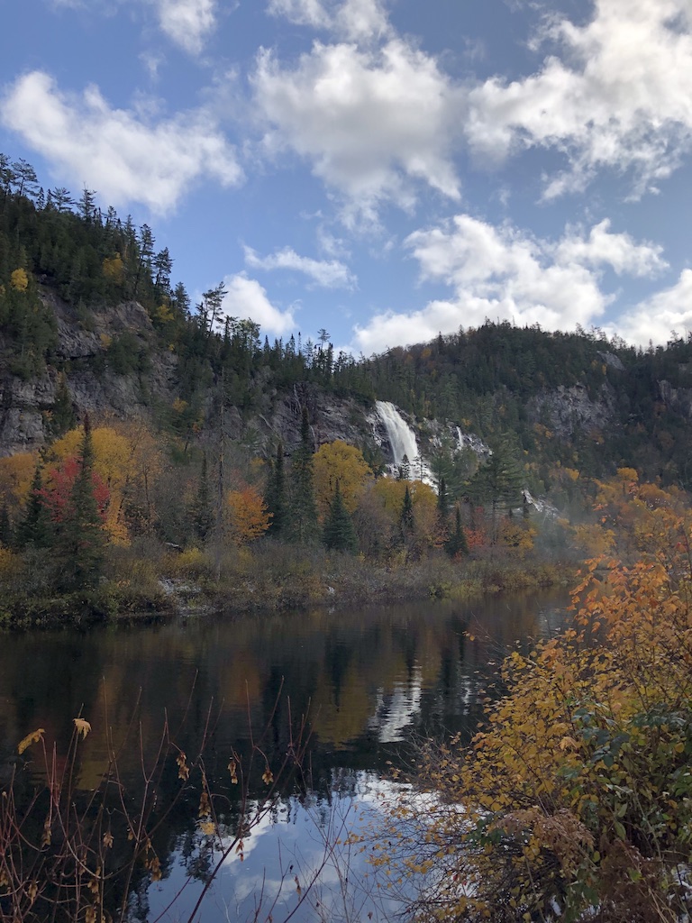
We walk about twenty minutes, enjoy the trail and the vibrant autumn colours along the river before reaching the beautiful Bridal Veils Falls, the tallest waterfall in the park.
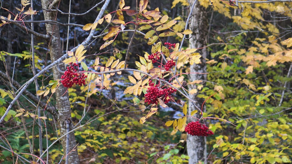
We see many white birch trees with their golden leaves and mountain ash trees with their red fruits that accentuate the landscape.
The water flow at all the falls in the canyon is contingent on runoff from snow and rainfall. We luck out that Bridal Veil Falls at 68.5m (225 ft.) are running strong. The Agawa River is the calm and reflective barrier that holds us back from getting closer to the falls.
The Talus Trail
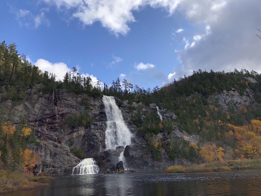
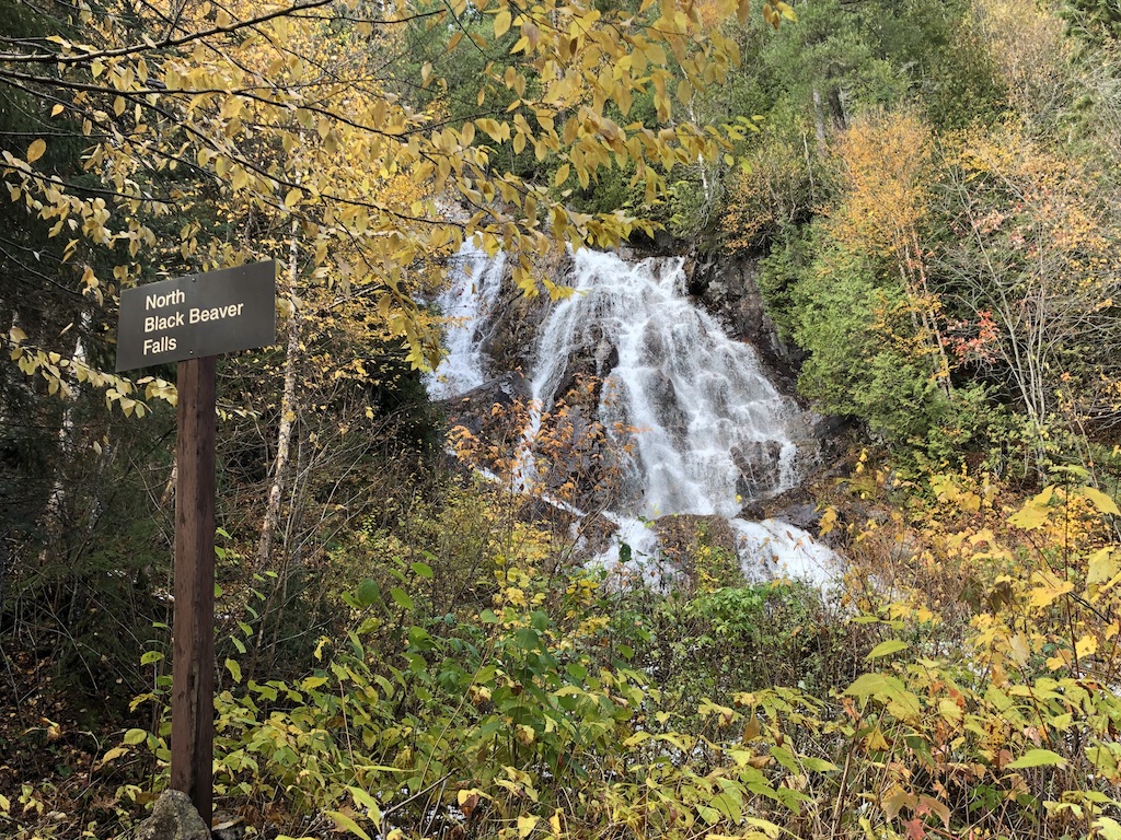
From the River Trail, we walk about fifteen minutes to reach the Talus Trail which follows along the base of the west canyon wall. This trail leads us past lichen covered talus slopes to the viewing platforms at North and South Black Beaver Falls.
We can hear the rushing sounds of water before reaching the viewing platforms. Black Beaver Falls at 53.3 m (175 ft) are also running strong and look so beautiful with the surrounding autumn foliage. We respect the Caution sign to keep off the rocks.

Clouds roll in and out while we pass bridges, creeks and waterfalls to return to the train. Altogether we walk 5 km and enjoy every minute of the hike in Agawa Canyon Park.


On our way back to Sault Ste. Marie, we get to see the spectacular landscapes again from our train windows. Everyone is wide-eyed to take in as much as possible the pristine beauty of Canada’s rugged wilderness.
Copyright © 2024 natalietheexplorer.home.blog – All rights reserved.
