Finishing a good book and starting another good book
Organizing my digital images (see below)
I organized my digital images of public art into themes and will post them in small batches. I named one of my themes Outside the Box for all sorts of painted boxes. Here’s the first batch.
Outside the Box
I photographed the following five utility boxes when I went for a walk in St. John’s, Newfoundland. There are seven images since the “Jellybean Houses” utility box has different paintings on three sides.
Picture 1: This is the front view of the utility box with painted houses and doors on actual doors.
Jellybean Houses – front
Picture 2: Side view of the same utility box. I like the painted flowers at the bottom. There is an actual green door behind the box, to the left of the picture.
Jellybean Houses – side
Picture 3: The back of the same utility box. Again, I like the painted shrubs and flowers at the bottom.
Jellybean Houses – back
Picture 4: An octopus in nice water bubbles.
Octopus
Picture 5: Quidi Vidi is a picturesque neighbourhood in St. John’s, Newfoundland and Labrador.
Quidi Vidi
Picture 6: These two boxes together show St. John’s Harbour. The wall behind them is a mural of sea life.
St. John’s Harbour
Picture 7: A violinist in bright colours; a sample of the rich music culture in St. John’s.
Violinist
As I reviewed my pictures, I am reminded that travel provides many gifts: Anticipation before the trip, participation during the trip and recollection after the trip. Going through my pictures brought back fond memories of my walk in St. John’s.
Where Are the Doors?
The paint hides the door handles and locks on these utility boxes. They are there if you look closely. Visit Dan’s Thursday Doors for more door photos.
Weekend Coffee Share
I’d love for you to share what’s been happening, simple joys from your week and/ or favourite public art photos from around the world in the comments or Weekend Coffee Share linkup #103 InLinkz below.
Hello and welcome to my blog! I’m glad you’re here. It’s week 46 in 2022 and I’m hosting Weekend Coffee Share linkup #96. Come on in for a coffee or tea, and let’s catch up.
I’m continuing the story of my adventures on the Bay of Fundy in New Brunswick and Nova Scotia. I wrote my adventures in three posts. The first post on five Natural Wonders is here and the second post on five Historic Sites is here.
This post is the third and last installment. I enjoyed visiting lighthouses, covered bridges and public art on the Bay of Fundy. Here’s six fun attractions to explore for free.
1. Masstown Market
Masstown Market is located 10 minutes west of Truro, Nova Scotia. Aside from the market, the lighthouse and interpretive centre has four floors to explore, with a lovely view from the top.
Masstown Market lighthouse and mural by local artist Andre Myette
2. Five Islands Lighthouse Park
The Five Islands Lighthouse Park is named after five small islands (east to west): Moose, Diamond, Long, Egg and Pinnacle. The Five Islands are collectively one of many geosites between Lower Truro and Cape Chignecto Provincial Park that form the Cliffs of Fundy UNESCO Global Geopark.
The wooden, “pepperpot”-style lighthouse was built at Sand Point in the winter of 1913-1914. It had to be moved back from the shoreline at Sand Point several times due to coastal erosion. It was moved in November 2008 from Sand Point to its new location at the municipal Five Islands Lighthouse Park overlooking the islands.
Five Islands Lighthouse Park
3. Giant Lobster
The Giant Lobster in Shediac, New Brunswick is a concrete and reinforced steel statue sculpted by Canadian artist Winston Bronnum in 1990. The statue is 11 metres long and 5 metres tall, weighing 90 tonnes.
Giant Lobster in Shediac
4. Sawmill Creek Bridge
Sawmill Creek bridge, built in 1905, is the last covered bridge on Highway 114 and one of the 58 covered bridges in New Brunswick. This covered bridge is 33 m (105 ft.) in length.
Sawmill Creek Bridge and the trail
5. Maud Lewis Replica House
Maud Lewis (1903-1970) is known for her bold and colourful paintings that featured outdoor scenes and animals, inspired by the landscapes of southwest Nova Scotia and painted on everything from Christmas cards to pulp boards.
She has been the subject of Maudie, the 2016 film starring Sally Hawkins and Ethan Hawke. Maud was born in Yarmouth County, Nova Scotia but she lived most of her life with her husband Everett Lewis in Digby County, Nova Scotia.
On the site of where her house stood is now a replica house built by Murray Ross. It is the same size as her original house. The original house has been moved and is on permanent display at the Art Gallery of Nova Scotia in Halifax.
Maud Lewis Replica House, Everett’s Shop and Maud’s Photo Chair
6. Murals
Here’s a gallery of murals with brief captions for your weekend. Click on the top left image to start and use the arrow to move through the gallery.
Murals in the Maritimes
The last mural, The Tide Flows, was created by Michael Burt and Daniel Burt in 2018 to mark Wolfville’s 125th anniversary as a town. A line of poetry from John Frederic Herbin’s book Marshlands added a focus: “The tide flows seaward as the day expands.”
*****
I enjoyed my adventures in New Brunswick and Nova Scotia. Now that I’ve been home for a while, I’m already thinking about my next adventure.
What free fun attraction(s) have you recently visited?
Hello and welcome to my blog! I’m glad you’re here. It’s week 45 in 2022 and I’m hosting Weekend Coffee Share linkup #95. Come on in for a coffee or tea, and let’s catch up.
Remembrance Day
November 11th is Remembrance Day in Canada. So I want to take a moment to honour all Canadian veterans who have served and continue to serve in upholding the peace and freedoms we enjoy today.
Poppy sculpture at The Royal Canadian Legion, Queen’s Own Rifles Branch
PPAC meets WCS
Today I’m combining Photographing Public Art Challenge (PPAC) with Weekend Coffee Share (WCS). I’ve been a PPAC participant so when Marsha at Always Write blog had to step back from hosting and she asked if anyone would be interested in taking over PPAC, I volunteered to host.
I continue to leave the topic open. There is no prompt or theme. Existing WCS participants are free to participate without any PPAC entries and PPAC participants are free to participate with one or more images of public art (outdoor and free) without writing their post as a coffee share.
To new WCS participants:
The weekly WCS linkup starts at 8 a.m. on Friday and ends at midnight Sunday night Eastern Standard Time.
Join the linkup using the InLinkz button at the end of my WCS post. If you prefer to leave a comment with your link, be aware that a link in my Comments section requires moderation and is less visible to participants who use InLinkz.
Please link one post, leave a comment on my blog and link back or pingback to my Weekend Coffee Share post. Links from bloggers who join without leaving me a comment will be removed.
Read one or more participating blogs and leave a comment. Hashtag #Weekendcoffeeshare.
I read all participating blogs and reply to comments left on my blog. I prioritize my visits and leave comments for bloggers who take the time to leave me a comment. Thank you.
Bay of Fundy: 5 Historic Sites
I’m continuing the story of my adventures on the Bay of Fundy in New Brunswick and Nova Scotia. I wrote my adventures in three posts. The first post on five Natural Wonders is here. This post is the second in the series.
The region surrounds the Bay of Fundy is rich with stories from the native Mi’kmaq people, Loyalist heritage and Acadian history. Here’s five Historic Sites on the Bay of Fundy to explore. Click on the top left image in the gallery to see captions and move through the gallery.
1. St. Andrews
St. Andrews, or Saint Andrews by-the-Sea, is nestled along Passamaquoddy Bay in New Brunswick. Founded by Loyalists in 1783, many buildings in St. Andrews still reflect that history. St. Andrews’ Historic District, one of the best-preserved examples of colonial heritage in North America, is a National Historic Site of Canada.
St. Andrews is also Canada’s oldest seaside resort town and a great place for whale watching, deer watching, outdoor recreation, dining and shopping. I’ll share more on St. Andrews in another post.
2. Saint John
Saint John located on the Bay of Fundy in New Brunswick is Canada’s first incorporated city, established by royal charter on May 18, 1785, during the reign of King George III. The city offers beautiful historic architecture, funky cafés, creative galleries and shops, and more. Saint John in New Brunswick is not to be confused with St. John’s in Newfoundland and Labrador.
Saint John City Market, established 1876, is Canada’s oldest farmers’ market. It is a good place to browse and pick up a snack, lunch, dinner, or local arts and crafts.
3. Digby
Named after Admiral Robert Digby, the town of Digby in Nova Scotia is famous for the local scallops and the fleet that harvests them. Along the Digby waterfront in Loyalist park are Digby Pier lighthouse and six cannons, five from Victorian era in the 1840s and one from the era of King George III sometime prior to 1820.
The cannons were part of fortifications constructed at Digby, primarily to protect the town from privateers. Each cannon has a plaque affixed to its carriage relating a small part of the story of the fortifications and the cannons.
4. Fort Anne
Set on the banks of the Annapolis River in Nova Scotia, Fort Anne was first fortified by the Scots as early as 1629. The site was later controlled by the French before falling for good to British troops in 1710. It would remain a regular scene of battles until the fall of Quebec in 1759. Fort Anne became Canada’s first administered National Historic Site in 1917.
It is a wonderful learning experience to stroll inside the fort and around the Perimeter Trail to explore a renovated 1797 Officers’ Quarters (now a museum) and a maze of defensive ditches, banks and bastions overlooking the Annapolis River.
5. The Landscape of Grand-Pré
The Landscape of Grand-Pré is both a National Historic Site of Canada and a UNESCO World Heritage Site. Situated on Nova Scotia’s southern Minas Basin, an inlet of the Bay Fundy, the Landscape of Grand Pré (Grand Pré means Great Marsh) is subjected to the most extreme tides in the world. The tidal range averages 11.6 metres and the tides move in and out of the Minas Basin every 12 hours.
Starting in the late 17th century – an era which predates the introduction of engineered drainage systems – the Acadian settlers applied an inventive and ingenious system of earthen dykes, ditches and aboiteaux, or wooden sluices, to hold back the formidable tides. They also began a tradition of collective management that was community-based. Today, the agricultural landscape is still protected and drained by the same system, still exhibits distinctive field patterns, and is still managed through the same community approach.
Parks Canada website
The landscape is beautiful and the dykes in Wolfville are amazing to examine in real life. Information boards posted at the historic sites give helpful explanatory notes.
I hope you join me next weekend to discover fun attractions on the Bay of Fundy.
Hello and welcome to my blog! I’m glad you’re here. It’s week 44 in 2022 and I’m hosting Weekend Coffee Share linkup #94. Come on in for a coffee or tea, and let’s catch up.
When I was planning for my trip to Nova Scotia and New Brunswick in September, I wanted to see several natural wonders and UNESCO World Heritage Sites on the Bay of Fundy. I had visited main attractions in Halifax and surrounding areas such as Lunenburg, Peggy’s Cove, and Cape Breton in Nova Scotia before. So for this trip I focused on new-to-me places.
I’m happy to say that I saw everything that I wanted to see and more. I wrote my adventures on the Bay of Fundy in three posts. This post is the first of three:
Natural wonders
Historic places
Fun attractions
The Bay of Fundy is renowned for its extremely high tidal range (the highest in the world), geological discoveries (dinosaur fossils) and marine life (whales). Here’s five amazing Natural Wonders to explore.
1. Joggins Fossil Cliffs
Joggins Fossil Cliffs on the Bay of Fundy in Nova Scotia is Canada’s 15th UNESCO World Heritage Site. Joggins is world famous because of its fossil record of life on land in the Coal Age. More than 300 million years ago, Joggins was home to giant insects, towering trees and the first known reptiles.
I enjoyed 1) A visit to the Joggins Fossil Centre to see an extensive fossil specimen collection, exhibits, and displays and learn about the “Coal Age,” when lush forests covered the Joggins region 2) A guided tour with knowledgeable interpretive staff to explore the coastal cliffs (up to 15 kilometres of magnificently exposed layers of rock) and look for fossils on the beach at low tide.
Joggins Fossil Cliffs and beach at low tide
Joggins Fossil Cliffs
Rock layers at Joggins Fossil Cliffs
Plant fossils at Joggins Fossil Centre
2. The World’s Highest Tide and Hopewell Rocks
The Hopewell Rocks also called the Flowerpot Rocks are rock formations caused by tidal erosion at the Hopewell Rocks Provincial Park in New Brunswick. This is where the power of the Bay of Fundy tides is most impressive. Not only does the tide rise 14 meters (46 feet) vertically, it also recedes almost two football fields horizontally.
I enjoyed 1) A visit to the Hopewell Rocks Interpretive Centre for an overview on geology, tides and wildlife 2) A walk with an interpretive guide to see the powerful tides and the 40-70 feet tall flowerpot rocks.
There are two highs and two lows each day, with about 6 hours and 13 minutes between each high and low tide. The bay water is brownish-red as organic sediment and red mud are stirred up from the sea bed by tides and currents.
Diamond Rock
Hopewell Rocks
During my visit, the tides covered Daniels Flats, named for one of this area’s early settlers, an immense mud flat that is 4 km (2.5 mi.) wide and stretches almost as far as Grindstone Island in the distance.
Daniels Flats
The tides also covered Lover’s Arch situated relatively high on the beach. The tide needs to rise 28 feet straight up before it touches the base of the archway. The Fundy tides can then continue to rise another 18 feet (5.5 meters) before starting to recede.
Lover’s Arch
3. Fundy Biosphere Reserve and Fundy National Park
Fundy National Park is in the heart of the UNESCO-designated Fundy Biosphere Reserve. Often draped in a blanket of summer fog, the lush lands of the Biosphere Reserve stretch farther than the eye can see. The park maintains 110 km of hiking trails, both inland and coastal, as well as guided nature walks and interpretive programs. I’d love to spend more time here.
Map of UNESCO-designated Fundy Biosphere Reserve
Red chairs at Fundy National Park
All biological communities, including people, lead lives under the inescapable influences unique to the Bay of Fundy. For example, fishing boats can only leave or dock at the wharf when the height of tide permits. The right time could be morning, noon, or night.
Boats by Alma wharf at low tide
4. Reversing Falls Rapids
Reversing Falls Rapids is a unique phenomenon created by the collision of the Bay of Fundy and the Saint John River. It was incredible to watch the tides of the Bay of Fundy actually force the water at the mouth of the Saint John River to reverse its flow.
The nearby Stonehammer Geopark, the only UNESCO-listed global geopark in North America, has information panels on the tides and the geology of the cliffs.
Reversing Falls Rapids
Stonehammer Geopark
5. Marine Life
A whale watching tour is a fantastic way to experience marine life in the Bay of Fundy. My tour with Quoddy Link Marine in St. Andrews was excellent. We passed by East Quoddy Lighthouse built in 1829, the oldest lighthouse in New Brunswick, and saw harbour seals, humpback whales, porpoises, sea birds, and more.
East Quoddy (or Head Harbour) Lighthouse
Crab, starfish, clams and sea urchinSeals, porpoises and whales – Images by Quoddy Link Marine crew
I look forward to combining Photographing Public Art Challenge with Weekend Coffee Share linkup and sharing historic sites on the Bay of Fundy next Friday.
Hello and welcome to my blog! I’m glad you’re here. It’s week 40 in 2022 and I’m hosting Weekend Coffee Share linkup #90. Come on in for a coffee or tea, and let’s catch up.
Last month I was on a tour in Nova Scotia and New Brunswick, two of three Canadian provinces that are known as the Maritimes in Eastern Canada. The third province in the Maritimes is Prince Edward Island.
Similar to my eating out in Newfoundland and Labrador in June, I ate out when I was in Nova Scotia and New Brunswick, primarily fish and seafood. Here’s a sampling of some of the delicious food that was on my plate while I was in New Brunswick.
On My Plate
Seafood salad in St. Andrews by-the-Sea
Blueberry pie with ice cream in St. Andrews by-the-Sea
Fish and chips with coleslaw in Alma
Chocolate cake with berry sauce and whipped cream in Alma
Lobster with coleslaw and potato salad in Shediac Bay
Chocolate cake in Saint John
Lobster Cooking Recipe
I got a Lobster Cooking recipe from Ron and Denise, owners of Shediac Bay Cruises. The traditional way of cooking lobsters is to boil them. Here’s the recipe:
Part 1 – Boiling
In a large pot, measure enough water to cover all the lobsters you are cooking.
Bring the water to boil.
Add about 1/2 cup (118 ml) of salt for each gallon of water used.
Place lobsters in boiling water. (Best to remove bands from claws. It can leave a rubber taste in meat. Use extra precaution handling lobsters.)
Wait for water to start boiling again before you time.
Part 2 – Boil times:
1/2 lb or .227 kg lobsters – 12-15 min.
1-2 lb or .454-.907 kg lobsters – 15-20 min.
2-4 lb or .907-1.814 kg lobsters – 20-25 min.
4-8 lb or 1.814-3.629 kg lobsters – 25-30 min.
8 lb and over or 3.629 kg+ lobsters – 4 min./ pound
Note: Freshly molted lobsters (Soft shells) boil 2-3 min. less.
Part 3 – Fringing
Once the lobsters are done boiling, plunge them in cold water. Same salt content as the cooking. It will do two things: “Fringe” the meat from the shell and allow for a juicier lobster, making it easier to shell the meat out. (Add ice cubes in the water. You want to go from hot to cold as fast as possible, for a good “Fringe”.)
Leave them in the cold water for about 10 min.
Once out of the cold water, keep lobster on their back, belly-up, this will preserve the juices in the lobster much longer.
Cooked lobsters will preserve in the fridge for at least 3 days after.
The whole process goes a lot better when using a strainer to go from Boiling, Fringing and Serving!
Part 4 – Serving
Enjoy a “freshly” cooked lobster served cold. You can’t get a better lobster. Avoid the garlic butter and lemon juice, you are just camouflaging the taste.
*****
Eating out while on vacation is definitely a treat as I rarely eat out when I’m at home. Monday October 10th is Canadian Thanksgiving holiday. I look forward to enjoying a family gathering and homemade meal. Happy weekend, everyone!
Hello and welcome to my blog! I’m glad you’re here. It’s week 37 in 2022 and I’m hosting Weekend Coffee Share linkup #87. Come on in for a coffee or tea, and let’s catch up.
The beautiful town of Brigus is situated on the Avalon Peninsula, about 70km (43 miles) from the capital city of St. John’s, in the province of Newfoundland and Labrador. Brigus was founded in 1612. The name “Brigus” is derived from “Brickhouse”, an old English town.
While in Brigus, I completed a self-guided tour of Hawthorne Cottage, a National Historic Site of Canada, then took a leisurely hike around charming streets sloping up into green cliffs to explore the town. Brigus’ well-kept old-style architecture, rustic stone walls, lush green gardens, and winding narrow lanes are reflective of its English, Irish, and Welsh heritage.
Here are my pictures of historic structures and scenery in Brigus. Except for the first two pictures, I grouped the rest of my pictures into three galleries. Click on any image in the gallery to see its bigger version and caption.
Hawthorne Cottage National Historic Site
Built in 1830, this charming cottage was the former home of Arctic explorer Captain Bob Bartlett, who took American explorer Robert Peary to the North Pole in 1909. I highly recommend the tour of the cottage. Many artifacts commemorate the family and Bartlett’s achievements as the greatest ice navigator of the 20th century.
Hawthorne Cottage National Historic Site
During the more than 50 years of his seafaring life, Captain Robert (Bob) Abram Bartlett skippered some of the most famous, dangerous, and controversial exploratory expeditions to the Arctic. He travelled further north than almost any other living person, was shipwrecked at least 12 times, survived for months in the inhospitable Arctic after sea ice crushed his ship, and journeyed hundreds of miles by dogsled to reach civilization. Despite these hardships, Bartlett returned to the Arctic whenever circumstance allowed and almost always came back with photographs, film reels, and scientific data that greatly contributed to the world’s understanding of the north.
Newfoundland and Labrador Heritage web site
View of Hawthorne Cottage from its gardens
Historic structures built in the 1800s
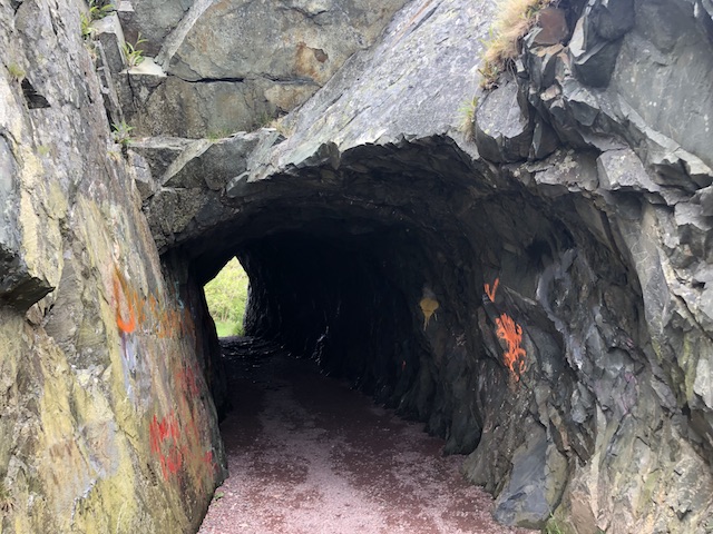
From top left, clockwise: St. George’s Heritage church built in 1876; Stonewalls line the river; The Tunnel bored through solid rock on Brigus waterfront in 1860; Pinkston’s Forge built in 1889; The Leamon Museum: Ye Olde Stone Barn built in the 1820s.
Brigus Bay and Bishop’s Beach
From top left, clockwise: Steel Sails Monument erected at Bishop’s Beach in 1972 commemorating Captain Bartlett; Directional signs in Brigus; Blue bench at Payne Family Park; View of Brigus Bay; Stone table and bench at Bishop’s Beach.
Brigus Homes and Town Hall
From top left, clockwise: Brigus Town Hall in a beautiful blue; Brigus winding lanes; Birdhouses on a post; Side door at the Baldwin’s; Door with green trimmings; A house in Brigus.
My visit to Hawthorne Cottage and Brigus was informative and enjoyable. I hope to take you on an idyllic island getaway next week.
Hello and welcome to my blog! I’m glad you’re here. It’s week 36 in 2022 and I’m hosting Weekend Coffee Share linkup #86. Come on in for a coffee or tea, and let’s catch up.
Trinity is a small town located on Trinity Bay on the Bonavista peninsula in Newfoundland, about 3 hours by road from the capital city, St. John’s.
The harbour at Trinity was first used by fishing ships around the 16th century. The Portuguese explorer Gaspar Corte-Real named the location “Trinity” as he arrived on Trinity Sunday, 1501.
Floating docks at Trinity Harbour
Before 1700, Trinity Harbour was mainly a summer station used by merchants and shipowners. After 1700, several major merchant houses from Poole, England selected Trinity as their headquarters and under their patronage Trinity developed as one of the main Newfoundland trading centres in the English fishery.
Trinity Harbour
The waterfront area on which once stood the commercial and fishery buildings of the Taverners, Lesters, Garlands and Lester-Garlands during the period 1700-1906 and in the twentieth century Ryan Brothers is named the Lester-Garland Provincial Historic Site. Some of the buildings were restored or reconstructed and are open for visitors.
The Lester-Garland Provincial Historic Site in Trinity
I picked up a map from Trinity’s Visitor Centre and explored on my own. A walk along Trinity’s scenic harbour and winding lanes lead to houses, museums, art galleries, and other historic buildings preserved from the 19th century. Information boards posted at the historic sites give helpful explanatory notes.
A grassy lane
Business signs
Lovely walking path
I created an image gallery of some of the historic sites and community buildings that I visited in Trinity below. For more history details on the buildings, check out the Town of Trinity website here. Click on the top left image and use the arrow to move through the gallery. Brief captions are included.
I thoroughly enjoyed my walk in the charming and historic town of Trinity. I found out after my visit that Trinity was named one of the 12 best small towns in Canada by Travel + Leisure magazine in 2021. I hope to take you to another scenic town next week.
Hello and welcome to my blog! I’m glad you’re here. It’s week 35 in 2022 and I’m hosting Weekend Coffee Share linkup #85. Come on in for a coffee or tea, and let’s catch up.
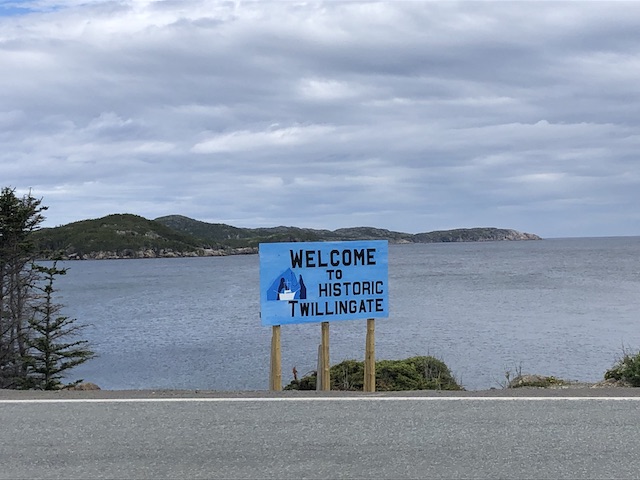
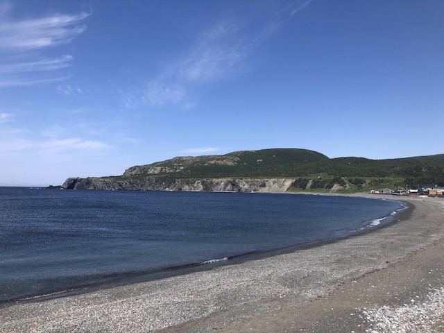
Before reaching St. John’s, the capital city of Newfoundland and Labrador, from Western Newfoundland, I passed through many small fishing communities and headed north to the town of Twillingate, located on the Twillingate Islands on the north east coast of Newfoundland.
Twillingate gets its name from the French word “Toulinquet,” given to the islands by French fishermen, who compared it to a group of islands off the French coast near Brest also called Toulinquet. Twillingate is known for icebergs, whales, ocean experiences and outdoor adventures. It was a historic fishing community (since the 1500s), but because of the decline of the fishing industry, its economy now relies more on tourism.
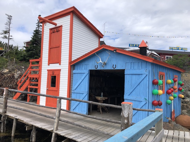
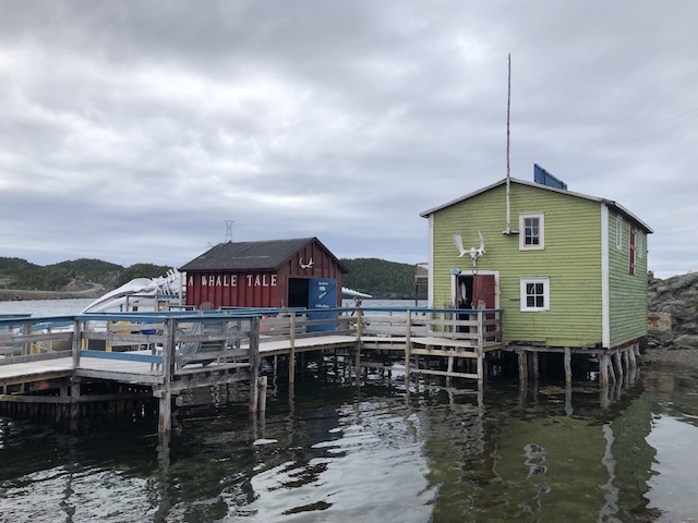
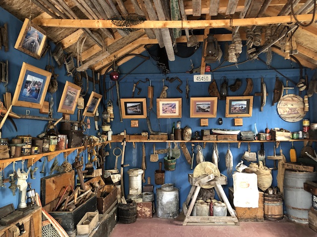
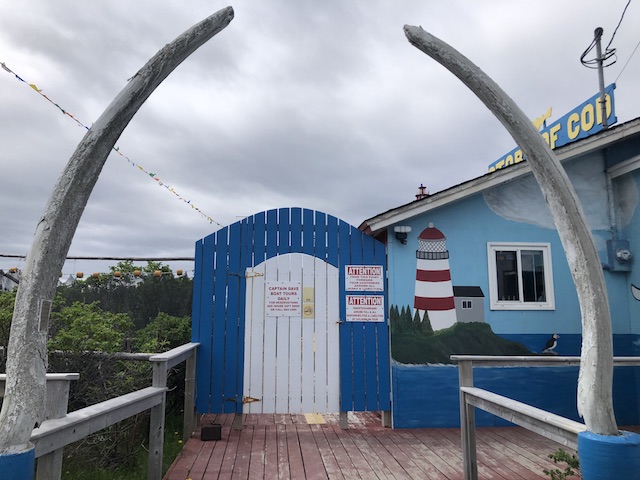
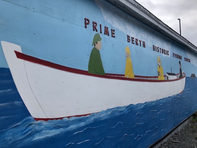
One of the attractions in Twillingate is the Prime Berth Fishing Heritage Centre. It is a private interpretive fishing center and craft studio created by David Boyd, with the support of his wife Christine, as a tribute to his fisher forefathers. Captain Dave also runs boat tours for iceberg viewing and whale watching.
Prime Berth refers to the age old practice of each spring holding a draw, or lottery of sorts, to determine the place, or “berth” where fishermen would set their cod traps during the coming summer. Everyone hoped and prayed that they would be lucky enough to draw the best spot, or “Prime Berth”, as it was called. In David’s case this was personal and special as all the fishermen gathered in his father’s kitchen each May for the annual cod trap draw. In honour of this tradition, and as a tribute to proud people so dear to his heart, David decided to call his heritage centre – “Prime Berth”- meaning literally -“the best spot!”
Prime Berth Fishing Heritage Centre
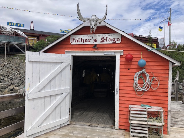
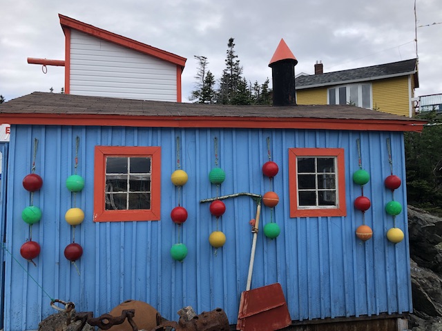
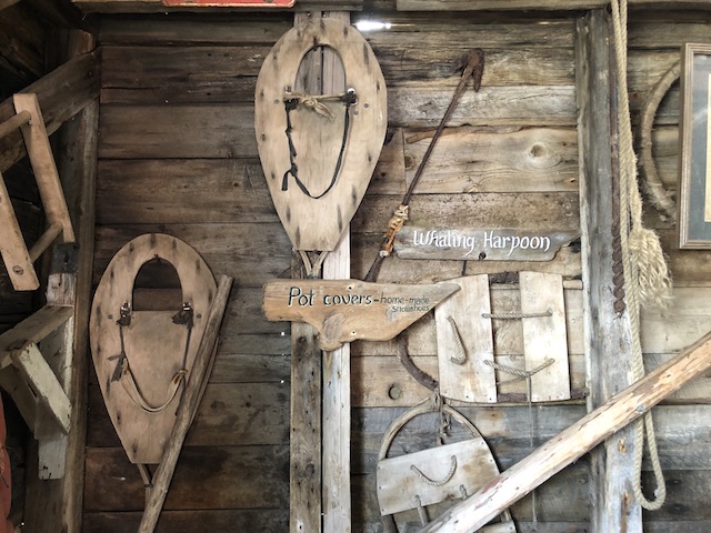
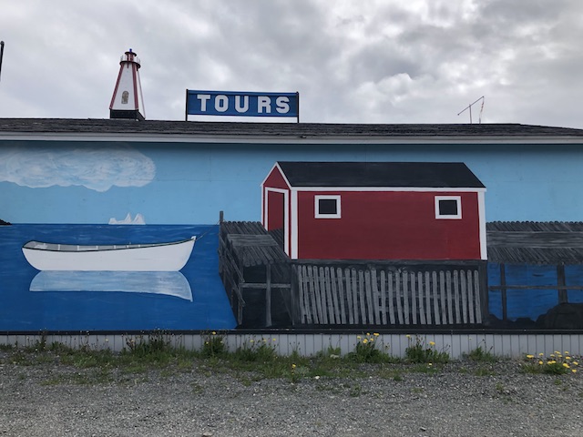
The following two slideshows highlight some of the displays that I found interesting at Prime Berth. Click on the arrows or swipe to move through the slides.
Buildings and Doors
These brightly painted buildings house fishing artifacts and tools. There are hundreds of items on display in the buildings and on or above the doors. The last picture shows the jaw bone of a fin whale found at Trinity Bay in the 1950s.
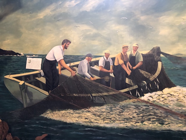
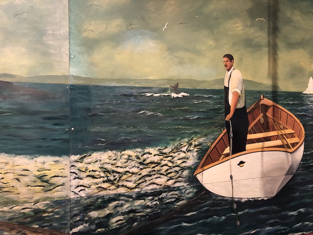
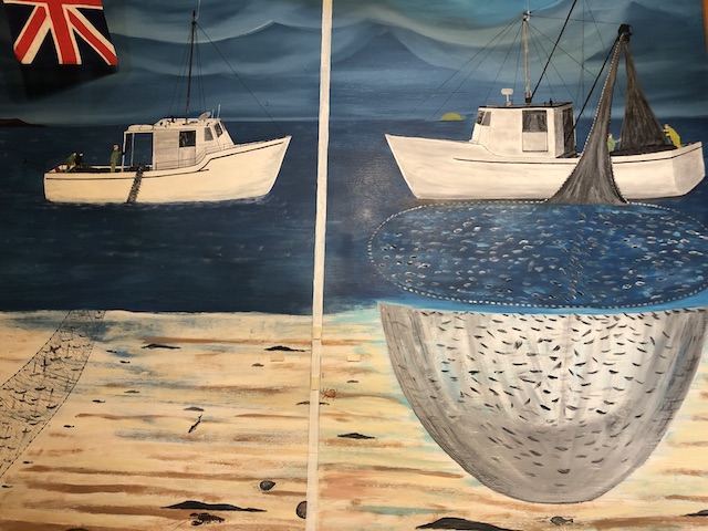
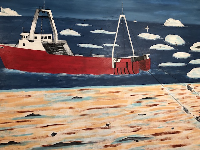
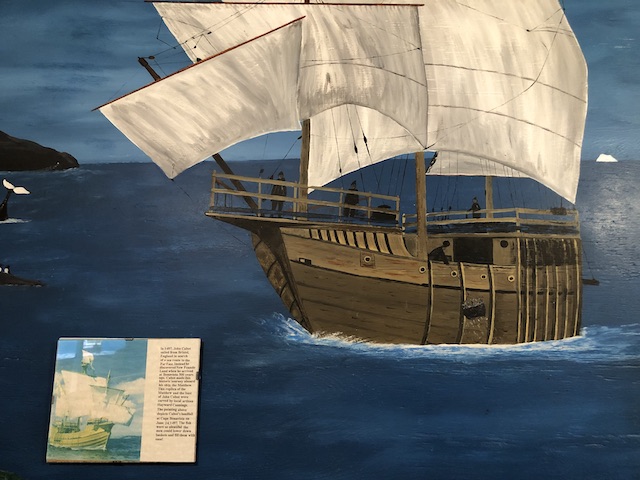
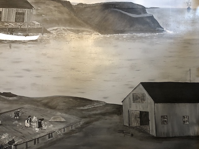
Murals
These murals depict life in a fishing community. Look closely to see fish, icebergs, whales, seabirds, boats, clapboard homes, fishermen and women, the ocean and the rocky coastline. The island of Newfoundland is nicknamed “The Rock” because of its rocky terrain and high cliffs.
I hope to take you on an easy walk in a charming and historic town next week.
Hello and welcome to my blog! I’m glad you’re here. It’s week 33 in 2022 and I’m hosting Weekend Coffee Share linkup #83. Come on in for a coffee or tea, and let’s catch up.
Today’s post is my postcard from St. John’s. After a long stretch of beautiful sunny days in Newfoundland and Labrador, I finally experienced overcast sky and brief periods of rain, drizzle and fog in St. John’s. I came prepared with my rain gear and took a long walk to explore this historic, artistic and colourful city.
St. John’s (always abbreviated and with an apostrophe) is the most easternly city in North America and Newfoundland and Labrador’s capital. St. John’s is not to be confused with Saint John in New Brunswick, another province in Atlantic Canada.
Art Works
Terry Fox Marathon of Hope Mile 0 Memorial
“I just wish people would realize that anything is possible if you try; dreams are made if people try”
Terry Fox (1958-1981)
If you don’t know who Terry Fox is, please read about him here.
Our Newfoundland and Labrador Dogs sculptures by sculptor Luben Boykov
A Time sculpture by sculptor Morgan MacDonald
A closer look at A Time sculpture
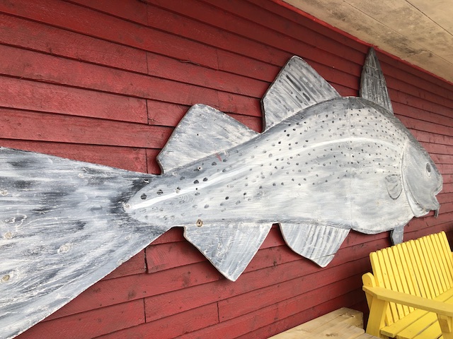
Making Fish sculpture by artist Jim Maunder
Art on the wall at William’s Lane
Historic Sites
Cabot Tower at the highest point of Signal Hill National Historic Site of Canada
Km 0 marker outside St. John’s City Hall
Km 0 marker of the Trans-Canada Highway that links ten Canadian provinces
Officially opened in 1962, the Trans-Canada Highway (TCH) is one of the longest highways in the world. From St. John’s, Newfoundland and Labrador, to Victoria, British Columbia, the TCH covers over 7821 km and crosses six time zones.
Jellybean Houses
There are blocks and blocks of brightly painted houses on the hilly streets that rise from St. John’s harbour.
Jellybean houses on Victoria Street in St.John’s
Jellybean houses in St. John’s
Colourful houses at St. John’s Harbour
Pubs and Music
George Street in downtown St. John’s has some of the best pubs and restaurants in Newfoundland, as well as all types of music – Irish, blues, rock n’ roll, dance, country and traditional music.
Hello and welcome to my blog! I’m glad you’re here. It’s week 32 in 2022 and I’m hosting Weekend Coffee Share linkup #82. Come on in for a coffee or tea, and let’s catch up.
In my previous post I shared a sampling of the delicious meals that I had in Newfoundland and Labrador. I worked them off by taking as many walks as possible. It was easy to do because the province has 29,000 kilometres of pristine coastline and close to 300 hiking and walking trails.
Here are five scenic walks that I enjoyed in western Newfoundland. As always, click on any image in the galleries to see its bigger version and caption.
1. Corner Brook Stream Trail
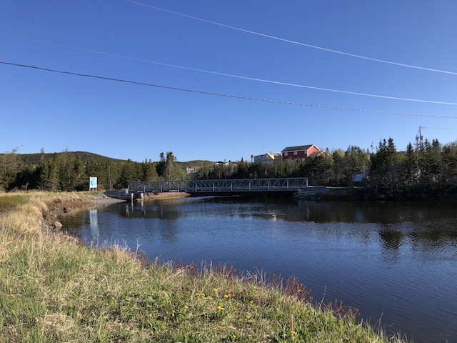
I was staying at Glynmill Inn and the Corner Brook Stream Trail was steps from the inn entrance so I did two walks, one in the morning and one in the afternoon in opposite directions. The trails are well defined with minimal elevation.
The morning walk took me along the beautiful trail to the wetlands and into the forest. Pretty wildflowers, bright dandelions and adorable chipmunks were part of a wonderful start to my day.
The afternoon walk took me to another beautiful forest, then a bridge that crosses rushing waters and Glynmill Inn Pond with swans before I returned to Glynmill Inn.
2. Trout River Boardwalk
Trout River is a small rural fishing town located on the southern coastal edge of Gros Morne National Park, near the Tablelands. This town is known for its boardwalk and trails that connect to the National Park. I enjoyed the views over the water and a walk through town.
Trout River was settled in 1815 by George Crocker and his family, who were its only inhabitants until 1880. In 2014, a blue whale carcass washed up along the shore in Trout River which attracted international attention. The skeleton of this whale was later put on display at the Royal Ontario Museum in Toronto.
3. Shallow Bay Trail
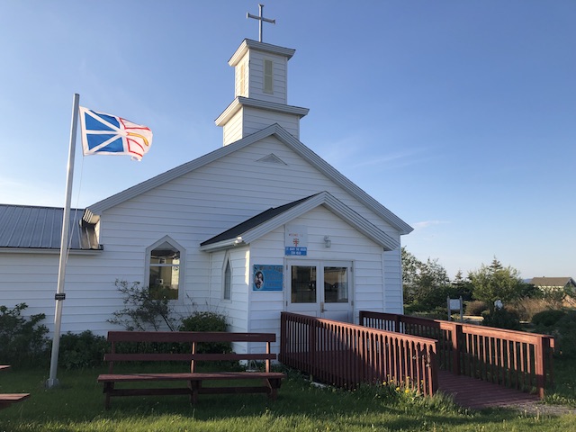
This 1.3-km loop trail is easy and perfect when short on time. I extended my walk to see St. Mary’s botanical garden, St. Mary’s church, and Dr. Henry N. Payne Museum & Craft Shop (the longest running museum on the West Coast of Newfoundland). I returned to Shallow Bay just in time for a spectacular sunset.
4. The Dorset Trail, Port au Choix
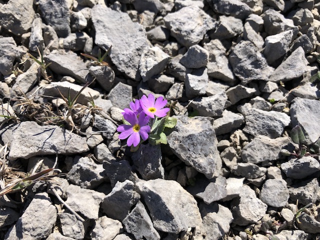
The Dorset Trail winds across limestone barrens and through forest and heathland to coastal archaeological sites dating back 2,800 years. This was one of my favourite trails for the unusual landscape. Although the ground may look bare, when I took a closer look, to my delight, I discovered many plants living and thriving on these barrens.
5. Bottom Brook Trail
Bottom Brook received its name due to its location at the bottom of St. Anthony Harbour. The 1.4-km loop trail is an easy walk on a beautiful morning to start my day. After the walk, I took a boat tour from St. Anthony Harbour to see icebergs, seabirds and whales.
*****
I love the uniqueness of the above walks and their beautiful natural surroundings. They are simple walks that I could fit in first thing in the morning to warm up, or last thing in the evening to wind down. I hope you enjoy the landscape as much as I did.