When in Rome in March, I took a 3.2 km (2 miles) walk to visit five piazzas (public squares) and fountains in the Eternal City. Rome’s piazzas are the centre of daily life. Come along and let me know what you think of the sights we see.
1. Piazza Navona
The Baroque-style Piazza Navona is built on the site where the Stadium of Domitian (Circus Agonalis), founded in 86 A.D., once stood. The most imposing buildings which look onto the square are the Church of Sant’Agnese in Agone and the Palazzo Pamphilj.

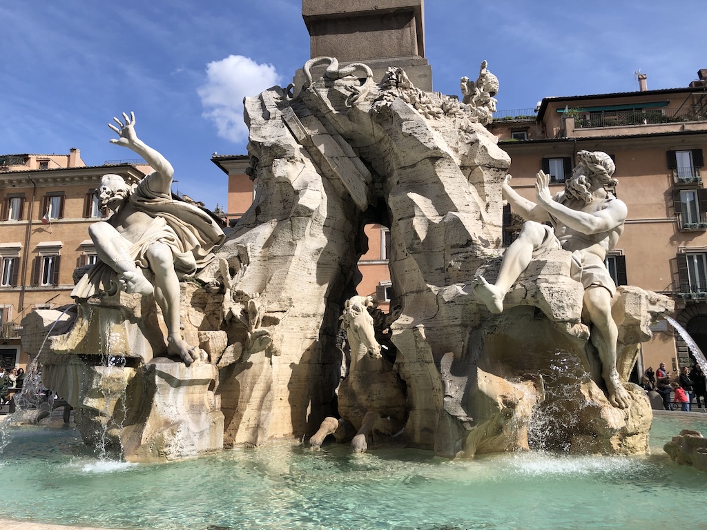
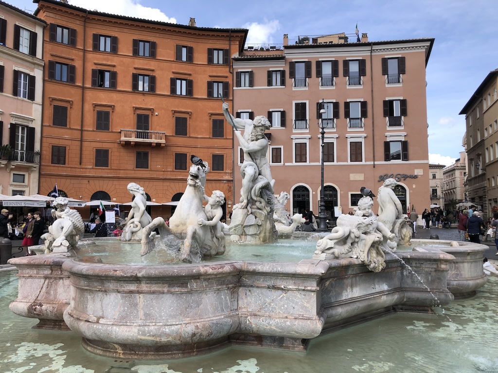
The most beautiful parts of Piazza Navona are its three fountains: Fountain of Neptune on the north end, Fountain of the Moor on the south end and Fountain of the Four Rivers with an obelisk in the centre of the square.
The Fountain of the Four Rivers was designed by Bernini in 1651. The four statues represent the most important rivers of the continents where Christianity had spread: the Nile with a lion (Africa), Danube with a horse (Europe), the Ganges with a dragon (Asia) and Rio de la Plata with an armadillo (America).

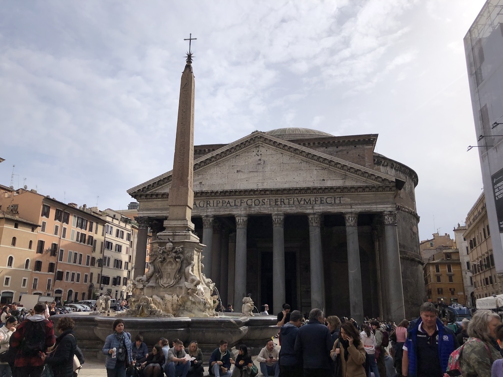
2. Piazza della Rotunda and the Pantheon
The Pantheon of Agrippa, also known as the Roman Pantheon, completed in 126 A.D., is the best preserved building from ancient Rome. I recommend entering the Pantheon to appreciate the awe-inspiring architecture:
- The rectangular facade is comprised of 16 granite columns which are each 14 meters in height.
- The circular building at the back has exactly the same diameter as its height: 43.5 metres.
- At its top, the enormous dome 9-meter diameter opening allows natural light to illuminate the entire building.


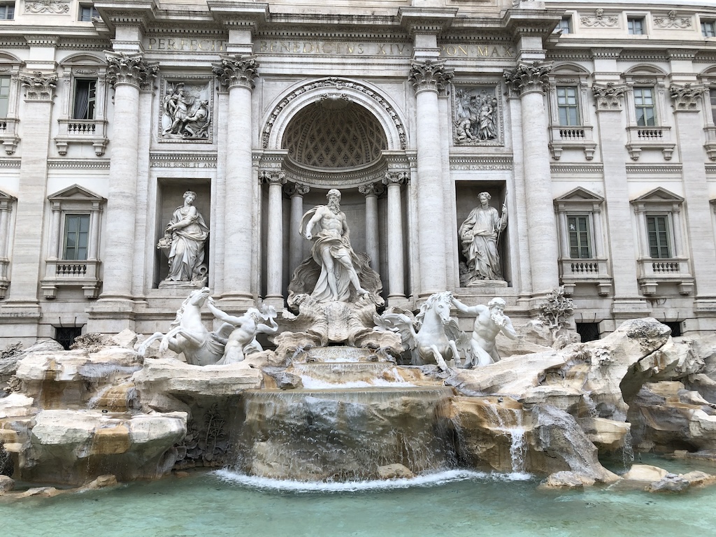
3. Trevi Fountain (Fontana di Trevi)
Trevi Fountain, completed in 1762, is the largest fountain in Rome. The name of Trevi derives from Tre Vie (three ways), since the fountain was the meeting point of three streets. The fountain shows statues of Tritons guiding the shell chariot of the god Oceanus, illustrating the theme of the taming of the waters. There are always people throwing coins in the water of Trevi Fountain. To find out why and what happens to the coins, click here.
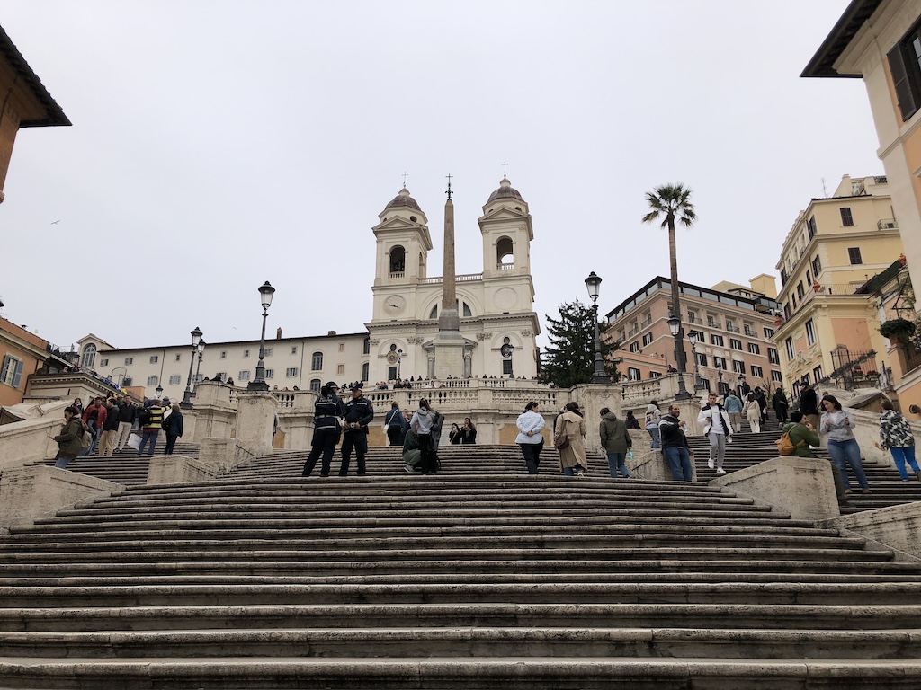
4. Piazza de Spagna and the Spanish Steps
Piazza de Spagna (Square of Spain) is where the majestic Spanish Steps, the longest and widest decorative steps in Europe, are located. At the bottom of the Spanish Steps is the Fountain of the Ugly Boat!
The Fountain of the Ugly Boat (Fontana della Barcaccia) was designed by Pietro Bernini, father of the famous Gian Lorenzo Bernini, who later helped with the creation. It was finished in 1627 and placed by Pope Urban III in the centre of Piazza di Spagna. It is shaped as a boat and has the emblems of the Barberini family (the Noble family of Pope Urban III), bees and a sun engraved.

5. Piazza della Republica
At the centre of the Piazza della Republica stands the majestic Fountain of the Nymphs (Fontana delle Naiadi) depicting four nymphs riding on sea monsters. It was constructed between 1870 and 1888 and decorated with four lion sculptures. In 1901 the lions were replaced by the statues of four water nymphs.


I hope you enjoy the walk. Thank you for coming along.
Link-Up
I’d love for you to share your week’s highlights and/ or public art from around the world in the Comments or Weekend Coffee Share link-up #159 below.
Copyright © 2024 natalietheexplorer.home.blog – All rights reserved.